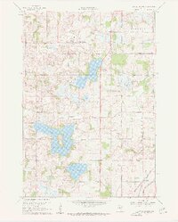
1960 Map of Little Chicago
USGS Topo · Published 1961About this map
Little Chicago stands at the heart of this post-war landscape, a rural crossroads in northern Rice County where agricultural fields meet a chain of substantial glacial lakes. To the south, the settlement of Millersburg serves as a local hub near the shores of Circle Lake, while the eastern portion of the survey is defined by the dual rail lines of the Chicago Milwaukee St Paul and Pacific and the Chicago Great Western railroads.
Find a feature on this map
27 named features on this map. Tap any name to fly to it.
Don’t see what you’re looking for? This feature index may not catch every label — zoom into the map to look around manually.
Map Details
Editions of this 1960 Little Chicago Map
2 editions found
Other maps of this area

1953 · Saint Paul
USGS Topo · 1:250,000

1957 · Farmington
USGS Topo · 1:62,500

1957 · Prior Lake
USGS Topo · 1:62,500

1959 · Saint Paul
USGS Topo · 1:250,000

1960 · Faribault
USGS Topo · 1:24,000

1960 · Northfield
USGS Topo · 1:24,000

1960 · Cannon City
USGS Topo · 1:24,000

1960 · Shieldsville
USGS Topo · 1:24,000

1960 · Lonsdale
USGS Topo · 1:24,000

1960 · Little Chicago
USGS Topo · 1:24,000