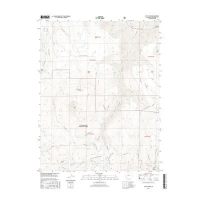
2016 Map of Little Cone
USGS Topo · Published 2016About this map
Sawpit sits at the northern edge of this high-altitude landscape, tucked along the San Miguel River where the river valley cuts through the surrounding plateaus. The topography is dominated by massive elevated features including Specie Mesa, Beaver Mesa, and Wilson Mesa, all of which transition into the dense woods of the Uncompahgre National Forest. Significant peaks like Little Cone and Flat Top Peak anchor the central and southern sections, while the steep descent into Specie Creek Canyon demonstrates the area's dramatic verticality.
Find a feature on this map
56 named features on this map. Tap any name to fly to it.
Don’t see what you’re looking for? This feature index may not catch every label — zoom into the map to look around manually.
Map Details
Editions of this 2016 Little Cone Map
This is the sole edition of this map. No revisions or reprints were ever made.
Other maps of this area

1897 · Telluride
USGS Topo · 1:62,500

1904 · Telluride
USGS Topo · 1:62,500

1909 · Montrose
USGS Topo · 1:125,000

1911 · Montrose
USGS Topo · 1:125,000

1945 · Durango
USGS Topo · 1:250,000

1953 · Mount Wilson
USGS Topo · 1:24,000

1953 · Dolores Peak
USGS Topo · 1:24,000

1953 · Placerville
USGS Topo · 1:24,000
1953 · Gray Head
USGS Topo · 1:24,000

1953 · Little Cone
USGS Topo · 1:24,000