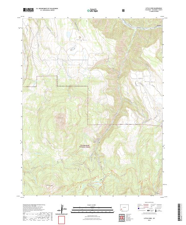
2022 Map of Little Cone
USGS Topo · Published 2022About this map
Little Cone and its distinctive summit anchor this high-elevation landscape in San Miguel County. The northern edge of the map features the settlement of Sawpit, situated along the San Miguel River and State Highway 145. This area represents a complex transition from the agricultural and residential reaches of Specie Mesa and Wilson Mesa to the protected wilderness of the Uncompahgre National Forest.
Find a feature on this map
54 named features on this map. Tap any name to fly to it.
Don’t see what you’re looking for? This feature index may not catch every label — zoom into the map to look around manually.
Map Details
Editions of this 2022 Little Cone Map
This is the sole edition of this map. No revisions or reprints were ever made.
Other maps of this area

1897 · Telluride
USGS Topo · 1:62,500

1904 · Telluride
USGS Topo · 1:62,500

1909 · Montrose
USGS Topo · 1:125,000

1911 · Montrose
USGS Topo · 1:125,000

1945 · Durango
USGS Topo · 1:250,000

1953 · Mount Wilson
USGS Topo · 1:24,000

1953 · Dolores Peak
USGS Topo · 1:24,000

1953 · Placerville
USGS Topo · 1:24,000
1953 · Gray Head
USGS Topo · 1:24,000

1953 · Little Cone
USGS Topo · 1:24,000