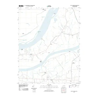
2010 Map of Little Cypress
USGS Topo · Published 2010About this map
Kincaid Mounds sit near the northern banks of the Ohio River, marking a landscape where ancient earthworks overlook modern river traffic. This confluence area is defined by the meeting of the Ohio River and the Tennessee River, creating a network of sloughs, bars, and creeks. Small settlements and landings like Ledbetter, Altona, and Possum Trot anchor the local road system, while family and community history is preserved in numerous burial grounds, including Leeper Cemetery and Hurley Cemetery. The map captures a transition from the broad river bottomlands to the interior drainage of Cypress Creek and Mud Creek. These waterways and their associated features, such as Goodlow Slough and Cottonwood Bar, illustrate the dynamic nature of this river-border region as it appeared in the early 21st century.
Find a feature on this map
62 named features on this map. Tap any name to fly to it.
Don’t see what you’re looking for? This feature index may not catch every label — zoom into the map to look around manually.
Map Details
Editions of this 2010 Little Cypress Map
This is the sole edition of this map. No revisions or reprints were ever made.
Other maps of this area

1926 · Paducah
USGS Topo · 1:62,500

1929 · Smithland
USGS Topo · 1:62,500

1929 · Paducah
USGS Topo · 1:62,500

1936 · Paducah
USGS Topo · 1:24,000

1936 · Elva
USGS Topo · 1:24,000

1936 · Smithland
USGS Topo · 1:48,000

1936 · Symsonia
USGS Topo · 1:24,000

1936 · Benton
USGS Topo · 1:48,000
1936 · Calvert City
USGS Topo · 1:24,000

1936 · Little Cypress
USGS Topo · 1:24,000