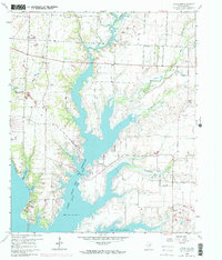
1969 Map of Little Elm
USGS Topo · Published 1969About this map
The rising waters of the Garza - Little Elm Reservoir dominate this 1969 revision, illustrating the transformative impact of mid-century water management on the North Texas landscape. The reservoir branches deep into the countryside, following the natural courses of Elm Creek and Doe Branch, while numerous sloughs like Nix Slough and Jefferson Slough fringe the western shore. Settlement patterns here are defined by small rural hubs such as Navo and Little Elm, which sits at a primary crossing point of the lake. Local heritage is preserved in numerous country burial grounds and sanctuaries, including the Mary Young Chapel (Zion Cem) and Oak Grove Cem. The presence of Camp Dallas and Camp Lucille near the water's edge reflects the area's mid-century shift toward recreation and seasonal residency as the reservoir system matured.
Find a feature on this map
29 named features on this map. Tap any name to fly to it.
Don’t see what you’re looking for? This feature index may not catch every label — zoom into the map to look around manually.
Map Details
Editions of this 1969 Little Elm Map
This is the sole edition of this map. No revisions or reprints were ever made.
Other maps of this area

1925 · Mc Kinney 3-c
USGS Topo · 1:48,000

1929 · Frisco
USGS Topo · 1:62,500

1954 · Sherman
USGS Topo · 1:250,000

1958 · Sherman
USGS Topo · 1:250,000

1960 · Frisco
USGS Topo · 1:24,000

1960 · Green Valley
USGS Topo · 1:24,000

1960 · Celina
USGS Topo · 1:24,000

1960 · Aubrey
USGS Topo · 1:24,000
1960 · Lewisville East
USGS Topo · 1:24,000
1960 · Hebron
USGS Topo · 1:24,000