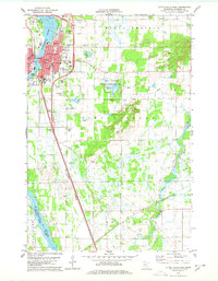
1978 Map of Little Falls East
USGS Topo · Published 1978About this map
The Mississippi River defines the western edge of this 1970s landscape, flowing past the city of Little Falls. The urban center is highly detailed, showing civic landmarks like the Courthouse, City Hall, and the Library, alongside numerous educational and religious institutions including St Francis High Sch and Our Lady of Lourdes Sch. South of the city, the Little Falls-Morrison Co Airport and a Drive-in Theater represent the era's infrastructure and leisure patterns.
Find a feature on this map
50 named features on this map. Tap any name to fly to it.
Don’t see what you’re looking for? This feature index may not catch every label — zoom into the map to look around manually.
Map Details
Editions of this 1978 Little Falls East Map
2 editions found
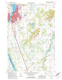
Other maps of this area

1948 · Belle Prairie
USGS Topo · 1:62,500

1948 · Pierz
USGS Topo · 1:62,500

1948 · Lastrup
USGS Topo · 1:62,500

1948 · Little Falls
USGS Topo · 1:62,500

1950 · Lastrup
USGS Topo · 1:62,500

1950 · Belle Prairie
USGS Topo · 1:62,500

1950 · Little Falls
USGS Topo · 1:62,500

1950 · Pierz
USGS Topo · 1:62,500

1953 · Brainerd
USGS Topo · 1:250,000

1953 · Saint Cloud
USGS Topo · 1:250,000
Featured Places
- Little Falls, MN
- Gregory, MN
- Maple Leaf Court, Little Falls
- Suburban Mobile Home Park, Little Falls
- Morrison County, MN