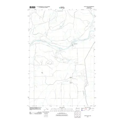
2011 Map of Little Falls
USGS Topo · Published 2011About this map
The Spokane Indian Reservation occupies much of the northern landscape on this Lincoln County map, where the terrain is defined by the winding course of the Spokane River. Near the center of the sheet, the Little Falls Dam represents a significant point of infrastructure at the settlement of Little Falls, harnessing the river's power as it flows westward. The topography is deeply etched by water, with Spring Creek Canyon and Smeltzer Canyon cutting through the southern plateau toward the river valley. Numerous Bureau of Indian Affairs routes, such as BIA Hwy 14 and BIA Hwy 34, provide access across the reservation land, connecting remote landmarks like Sherwood Mountain and Mathews Lake. This modern survey records the enduring physical character of the river valley and the specific road network serving the Spokane tribal lands.
Find a feature on this map
37 named features on this map. Tap any name to fly to it.
Don’t see what you’re looking for? This feature index may not catch every label — zoom into the map to look around manually.
Map Details
Editions of this 2011 Little Falls Map
This is the sole edition of this map. No revisions or reprints were ever made.
Other maps of this area

1944 · Wellpinit
USGS Topo · 1:62,500

1945 · Reardan
USGS Topo · 1:62,500

1948 · Turtle Lake
USGS Topo · 1:62,500

1950 · Turtle Lake
USGS Topo · 1:62,500

1953 · Reardan
USGS Topo · 1:62,500

1953 · Wellpinit
USGS Topo · 1:62,500

1953 · Ritzville
USGS Topo · 1:250,000

1955 · Spokane
USGS Topo · 1:250,000

1958 · Spokane
USGS Topo · 1:250,000

1959 · Ritzville
USGS Topo · 1:250,000