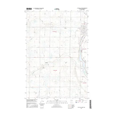
2016 Map of Little Falls West
USGS Topo · Published 2016About this map
The Mississippi River and its confluence with the Swan River anchor the landscape of this Morrison County region, showing the western outskirts of Little Falls and the village of Sobieski. The map reveals a dense concentration of cultural and genealogical sites, including several well-preserved parish and family grounds such as Our Lady of Lourdes Cem and the Kay Burial Ground. The terrain is characterized by a high water table and numerous glacial features, from the smaller Twin Lakes and Star Lake to the more expansive Zebulon Pike Lake. The presence of the Saint Stanislaus Church Cem suggests the deep roots of the local community, while the surrounding marshlands and creeks like Pike Cr and Hay Cr highlight the drainage patterns that have historically shaped local agriculture and development in central Minnesota.
Find a feature on this map
91 named features on this map. Tap any name to fly to it.
Don’t see what you’re looking for? This feature index may not catch every label — zoom into the map to look around manually.
Map Details
Editions of this 2016 Little Falls West Map
This is the sole edition of this map. No revisions or reprints were ever made.
Other maps of this area

1947 · Flensburg
USGS Topo · 1:25,000

1948 · Belle Prairie
USGS Topo · 1:62,500

1948 · Cushing
USGS Topo · 1:62,500

1948 · Little Falls
USGS Topo · 1:62,500

1950 · Swanville
USGS Topo · 1:62,500

1950 · Belle Prairie
USGS Topo · 1:62,500

1950 · Little Falls
USGS Topo · 1:62,500

1950 · Cushing
USGS Topo · 1:62,500

1951 · Flensburg
USGS Topo · 1:25,000

1953 · Brainerd
USGS Topo · 1:250,000