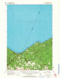
1956 Map of Little Girls Point
USGS Topo · Published 1966About this map
The Montreal River defines the rugged border between Wisconsin and Michigan as it flows toward its dramatic terminus at Lake Superior. This 1956 field survey captures the coastal landscape of the Bad River Indian Reservation and the western edge of the Ottawa National Forest. Infrastructure of the era is anchored by a Powerhouse near the river's mouth, utilizing the natural drop of Saxon Falls and Superior Falls. Along the shoreline, the community centers of Saxon and the recreational grounds of Little Girls Point serve as focal points for local life. The map illustrates the region's transport network just as the Duluth South Shore and Atlantic and Chicago and North Western railroads facilitated the movement of timber and ore through the northern woods. Small landmarks like Peterson Chapel, Saxon Union Ch, and Lake Sch provide essential clues for genealogists tracing family roots in this borderland.
Find a feature on this map
38 named features on this map. Tap any name to fly to it.
Don’t see what you’re looking for? This feature index may not catch every label — zoom into the map to look around manually.
Map Details
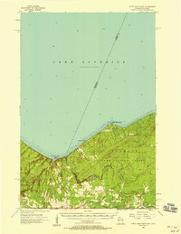
Editions of this 1956 Little Girls Point Map
2 editions found
Other maps of this area

1940 · Upson
USGS Topo · 1:48,000

1942 · Mellen
USGS Topo · 1:48,000

1943 · Little Girls Point
USGS Topo · 1:24,000

1943 · Upson
USGS Topo · 1:48,000

1943 · Ironwood
USGS Topo · 1:48,000

1943 · Little Girl Point
USGS Topo · 1:48,000

1943 · Odanah
USGS Topo · 1:48,000

1945 · Odanah
USGS Topo · 1:48,000

1945 · Mellen
USGS Topo · 1:48,000

1953 · Ashland
USGS Topo · 1:250,000