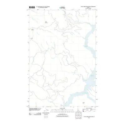
2011 Map of Little Green Mountain
USGS Topo · Published 2011About this map
Dworshak Reservoir dominates the eastern and southern edges of this Idaho backcountry, where the North Fork Clearwater River was impounded. The landscape is defined by steep drainage basins and prominent peaks like Little Green Mountain and Jericho Mountain. For those interested in mining history, the Jericho Mine is situated on the western slopes, reflecting the resource extraction that shaped the development of Clearwater County.
Find a feature on this map
21 named features on this map. Tap any name to fly to it.
Don’t see what you’re looking for? This feature index may not catch every label — zoom into the map to look around manually.
Map Details
Editions of this 2011 Little Green Mountain Map
This is the sole edition of this map. No revisions or reprints were ever made.
Other maps of this area

1923 · Washington Creek
USGS Topo · 1:125,000

1936 · Boehls Butte
USGS Topo · 1:48,000

1938 · Headquarters
USGS Topo · 1:48,000

1943 · Boehls Butte
USGS Topo · 1:62,500

1944 · Headquarters
USGS Topo · 1:62,500

1955 · Pullman
USGS Topo · 1:250,000

1956 · Hamilton
USGS Topo · 1:250,000

1958 · Pullman
USGS Topo · 1:250,000

1959 · Hamilton
USGS Topo · 1:250,000

1960 · Hamilton
USGS Topo · 1:250,000