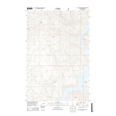
2014 Map of Little Green Mountain
USGS Topo · Published 2014About this map
Little Green Mtn and Jericho Mtn dominate this portion of the Clearwater National Forest, where steep drainage networks define the rugged Idaho landscape. The map captures the western edge of the Dworshak Reservoir, a significant geographic feature that transformed the local river systems into a massive slack-water pool. Numerous named tributaries, including the uniquely titled Pick and Pan Cr and the winding Swamp Cr, feed into larger basins, illustrating the complex watershed of the North Fork Clearwater River region. The absence of primary roads or permanent settlements highlights the area's character as a timber and backcountry zone, marked only by natural high points like Bartlett Point and seasonal access routes. Researchers can trace the specific land divisions across the T39N R3E and T38N R3E township lines, which help orient the positioning of remote creeks such as Baldy Bear Cr and Falls Cr.
Find a feature on this map
23 named features on this map. Tap any name to fly to it.
Don’t see what you’re looking for? This feature index may not catch every label — zoom into the map to look around manually.
Map Details
Editions of this 2014 Little Green Mountain Map
This is the sole edition of this map. No revisions or reprints were ever made.
Other maps of this area

1923 · Washington Creek
USGS Topo · 1:125,000

1936 · Boehls Butte
USGS Topo · 1:48,000

1938 · Headquarters
USGS Topo · 1:48,000

1943 · Boehls Butte
USGS Topo · 1:62,500

1944 · Headquarters
USGS Topo · 1:62,500

1955 · Pullman
USGS Topo · 1:250,000

1956 · Hamilton
USGS Topo · 1:250,000

1958 · Pullman
USGS Topo · 1:250,000

1959 · Hamilton
USGS Topo · 1:250,000

1960 · Hamilton
USGS Topo · 1:250,000