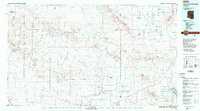
1988 Map of Little Horn Mountains
USGS Topo · Published 1988About this map
Kofa National Wildlife Refuge and the extensive Yuma Proving Ground dominate this 1980s landscape, illustrating the intersection of conservation and military activity in the Arizona desert. The map captures a region defined by arid basins and prominent peaks, including Courthouse Mountain and Polaris Mountain. To the south, the Gila River winds through the Hyder Valley, providing a corridor for small settlements like Hyder and Montezuma.
Find a feature on this map
62 named features on this map. Tap any name to fly to it.
Don’t see what you’re looking for? This feature index may not catch every label — zoom into the map to look around manually.
Map Details
Editions of this 1988 Little Horn Mountains Map
2 editions found
Other maps of this area

1927 · Hyder
USGS Topo · 1:62,500

1928 · Norton
USGS Topo · 1:62,500

1929 · Aztec
USGS Topo · 1:62,500

1929 · Norton
USGS Topo · 1:62,500

1930 · Stoval
USGS Topo · 1:62,500

1930 · Hyder
USGS Topo · 1:62,500

1942 · Yuma
USGS Topo · 1:250,000

1942 · Blythe
USGS Topo · 1:250,000

1942 · Vicksburg
USGS Topo · 1:250,000

1949 · Sentinel
USGS Topo · 1:62,500