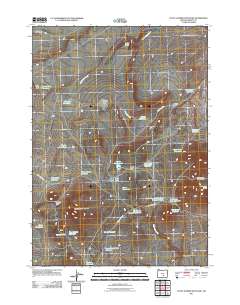
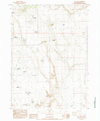
2011 Map of Little Juniper Mountain
USGS Topo · Published 2011About this map
McDaniels Cabin and the surrounding high desert of Harney County are defined by a complex network of seasonal water sources and landmarks. This remote landscape centers on Little Juniper Mountain and Horsehead Mountain, where the topography dictates the flow of Smokeout Creek and numerous drainages like Stormy Draw. The reliance on water management is evident through the many reservoirs and waterholes, such as Linahan Lake, Bunchgrass Reservoir, and Clear Waterhole, which support the region's livestock and wildlife. Movement through this arid terrain follows established routes like the Dry Valley Hwy and Little Juniper Rd, connecting isolated features like Dobie Flat and the Five Corners Reservoir. The map illustrates a high-desert environment where every named spring and catchment, from Horsehead Spring to Settlement Reservoir, is essential for navigation and survival.
Find a feature on this map
39 named features on this map. Tap any name to fly to it.
Don’t see what you’re looking for? This feature index may not catch every label — zoom into the map to look around manually.
Map Details
Editions of this 2011 Little Juniper Mountain Map
This is the sole edition of this map. No revisions or reprints were ever made.
Other maps of this area

1955 · Burns
USGS Topo · 1:250,000

1958 · Burns
USGS Topo · 1:250,000

1959 · Burns
USGS Topo · 1:250,000

1980 · Wagontire Mtn West
USGS Topo · 1:24,000

1980 · Alec Butte
USGS Topo · 1:24,000

1980 · Wagontire Mtn East
USGS Topo · 1:24,000
1984 · Dry Valley Rim
USGS Topo · 1:24,000
1984 · Goose Egg Butte
USGS Topo · 1:24,000
1984 · Venator Canyon
USGS Topo · 1:24,000
1984 · Cox Canyon
USGS Topo · 1:24,000