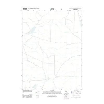
2012 Map of Little Juniper Reservoir
USGS Topo · Published 2012About this map
Little Juniper Reservoir serves as a primary hydrological landmark in this high-elevation landscape of Modoc County. The terrain is defined by a dendritic network of seasonal and perennial drainages, including the branching headwaters of Little Juniper Cr and the broad sweep of Big Juniper Cr. These watercourses dictate the local geography, leading toward the smaller Romero Reservoir and the isolated Nelson Springs in the southern portion of the quadrangle. Transportation is limited to a sparse network of rural routes such as Lyneta Rd and Co Rd 151, reflecting the area's character as a managed natural resource zone. The mapping of Fitzhugh Cr and the S Fork Fitzhugh Cr provides a clear view of the watershed patterns that have long influenced land use and ranching boundaries in this corner of California.
Find a feature on this map
10 named features on this map. Tap any name to fly to it.
Don’t see what you’re looking for? This feature index may not catch every label — zoom into the map to look around manually.
Map Details
Editions of this 2012 Little Juniper Reservoir Map
This is the sole edition of this map. No revisions or reprints were ever made.
Other maps of this area

1886 · Alturas
USGS Topo · 1:250,000

1892 · Alturas
USGS Topo · 1:250,000

1954 · Alturas
USGS Topo · 1:250,000

1958 · Alturas
USGS Topo · 1:250,000

1961 · Alturas
USGS Topo · 1:62,500

1962 · Alturas
USGS Topo · 1:250,000

1962 · Tule Mountain
USGS Topo · 1:24,000

1962 · Jess Valley
USGS Topo · 1:24,000

1962 · Likely
USGS Topo · 1:62,500

1963 · Little Juniper Reservoir
USGS Topo · 1:24,000