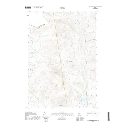
2021 Map of Little Kennebago Lake
USGS Topo · Published 2021About this map
The Canada United States of America international boundary cuts across the northwestern corner of this landscape, marking a remote borderland defined by high peaks and water systems. The Kennebago Divide serves as a central spine, separating the headwaters of the Cupsuptic River to the west from the Kennebago River drainage to the east. Several prominent summits anchor the terrain, including White Cap Mtn and Snow Mtn, while the southeastern corner is dominated by the waters of Little Kennebago Lake.
Find a feature on this map
35 named features on this map. Tap any name to fly to it.
Don’t see what you’re looking for? This feature index may not catch every label — zoom into the map to look around manually.
Map Details
Editions of this 2021 Little Kennebago Lake Map
This is the sole edition of this map. No revisions or reprints were ever made.
Other maps of this area

1928 · Chain Lakes
USGS Topo · 1:48,000

1931 · Cupsuptic
USGS Topo · 1:48,000

1932 · Kennebago Lake
USGS Topo · 1:48,000

1932 · Arnold Pond
USGS Topo · 1:48,000

1932 · Chain Lakes
USGS Topo · 1:62,500

1934 · Cupsuptic
USGS Topo · 1:62,500

1935 · Kennebago Lake
USGS Topo · 1:62,500

1935 · Chain Lakes
USGS Topo · 1:62,500

1935 · Cupsuptic
USGS Topo · 1:62,500

1935 · Arnold Pond
USGS Topo · 1:62,500