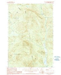
1990 Map of Little Kennebago Lake
USGS Topo · Published 1990About this map
Little Kennebago Lake and its surrounding drainage basin define the southern reaches of this Maine landscape along the Canadian border. The area is marked by a complex system of watercourses, including the Kennebago River and the Cupsuptic River, which carve through the high elevations of White Cap Mountain and Snow Mtn. This late 20th-century survey documents the townships of Stetsontown, Upper Cupsuptic, and Oxbow, areas dominated by timber management and remote waterways rather than traditional residential settlements. Historical land use is evidenced by a Gravel Pit and various logging routes that follow the natural contours of Sable Ridge and Cow Ridge. The map captures the meeting of international and county boundaries, including the Canada United States border and the line dividing Oxford and Franklin Counties.
Find a feature on this map
33 named features on this map. Tap any name to fly to it.
Don’t see what you’re looking for? This feature index may not catch every label — zoom into the map to look around manually.
Map Details
Editions of this 1990 Little Kennebago Lake Map
2 editions found
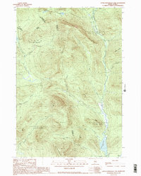
Other maps of this area

1928 · Chain Lakes
USGS Topo · 1:48,000

1931 · Cupsuptic
USGS Topo · 1:48,000

1932 · Kennebago Lake
USGS Topo · 1:48,000

1932 · Arnold Pond
USGS Topo · 1:48,000

1932 · Chain Lakes
USGS Topo · 1:62,500

1934 · Cupsuptic
USGS Topo · 1:62,500

1935 · Kennebago Lake
USGS Topo · 1:62,500

1935 · Chain Lakes
USGS Topo · 1:62,500

1935 · Cupsuptic
USGS Topo · 1:62,500

1935 · Arnold Pond
USGS Topo · 1:62,500