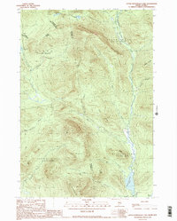
1990 Map of Little Kennebago Lake
USGS Topo · Published 1990About this map
The White Cap Divide defines the hydrological and political landscape of this Maine-Quebec border region, separating the headwaters of the Kennebago River from the Cupsuptic River system. The map details the unorganized territories of Stetsontown, Seven Ponds, and Upper Cupsuptic, revealing a backcountry of named ridges and remote water bodies such as White Cap Pond and Little Kennebago Lake.
Find a feature on this map
35 named features on this map. Tap any name to fly to it.
Don’t see what you’re looking for? This feature index may not catch every label — zoom into the map to look around manually.
Map Details
Editions of this 1990 Little Kennebago Lake Map
2 editions found
Other maps of this area

1928 · Chain Lakes
USGS Topo · 1:48,000

1931 · Cupsuptic
USGS Topo · 1:48,000

1932 · Kennebago Lake
USGS Topo · 1:48,000

1932 · Arnold Pond
USGS Topo · 1:48,000

1932 · Chain Lakes
USGS Topo · 1:62,500

1934 · Cupsuptic
USGS Topo · 1:62,500

1935 · Kennebago Lake
USGS Topo · 1:62,500

1935 · Chain Lakes
USGS Topo · 1:62,500

1935 · Cupsuptic
USGS Topo · 1:62,500

1935 · Arnold Pond
USGS Topo · 1:62,500