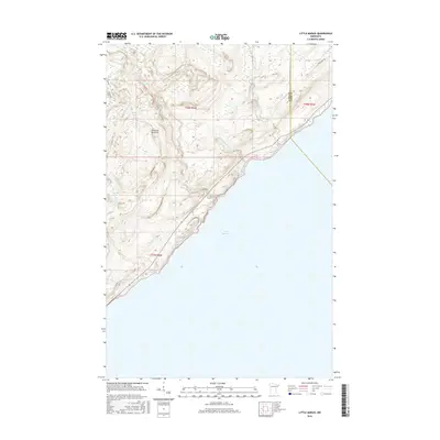
2016 Map of Little Marais
USGS Topo · Published 2016About this map
Lake Superior dominates the southeastern horizon of this coastal landscape, where the rugged North Shore terrain rises sharply from the water toward the heights of Sawtooth Mountain. This 2016 survey illustrates the complex drainage network of the region, featuring several prominent waterways including the Manitou River and the Caribou River as they descend toward the lake. The map reveals a sparsely settled interior accessed by local routes such as Cramer Rd and High Ridge Dr. Significant elevation changes are marked by features like Bensen Lake, located in the northwestern reaches. The boundary between Lake and Cook counties cuts through the northeastern corner, highlighting the administrative division in this predominantly forested and hydrologically rich environment defined by the Little Manitou River and Little Marais River.
Find a feature on this map
14 named features on this map. Tap any name to fly to it.
Don’t see what you’re looking for? This feature index may not catch every label — zoom into the map to look around manually.
Map Details
Editions of this 2016 Little Marais Map
This is the sole edition of this map. No revisions or reprints were ever made.
Other maps of this area

1954 · Two Harbors
USGS Topo · 1:250,000

1955 · Schroeder
USGS Topo · 1:24,000

1955 · Tofte
USGS Topo · 1:62,500

1955 · Cramer
USGS Topo · 1:62,500

1956 · Little Marais
USGS Topo · 1:24,000

1956 · Finland
USGS Topo · 1:24,000

1956 · Finland
USGS Topo · 1:62,500

1956 · Illgen City
USGS Topo · 1:24,000

1957 · Two Harbors
USGS Topo · 1:250,000

1958 · Two Harbors
USGS Topo · 1:250,000