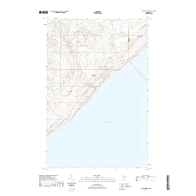
2019 Map of Little Marais
USGS Topo · Published 2019About this map
The Sawtooth Mountains rise sharply from the North Shore in this 2019 survey, defining a landscape of steep relief and rapid drainage into Lake Superior. This shoreline section captures the transition from the lake's expanse to the elevated ridges of the interior, where the Manitou River and Caribou River carve their way toward the coast. The topography here is characterized by these parallel watercourses, including the Little Manitou River and the Little Marais River, which drain the dense upland areas around Bensen Lake.
Find a feature on this map
14 named features on this map. Tap any name to fly to it.
Don’t see what you’re looking for? This feature index may not catch every label — zoom into the map to look around manually.
Map Details
Editions of this 2019 Little Marais Map
This is the sole edition of this map. No revisions or reprints were ever made.
Other maps of this area

1954 · Two Harbors
USGS Topo · 1:250,000

1955 · Schroeder
USGS Topo · 1:24,000

1955 · Tofte
USGS Topo · 1:62,500

1955 · Cramer
USGS Topo · 1:62,500

1956 · Little Marais
USGS Topo · 1:24,000

1956 · Finland
USGS Topo · 1:24,000

1956 · Finland
USGS Topo · 1:62,500

1956 · Illgen City
USGS Topo · 1:24,000

1957 · Two Harbors
USGS Topo · 1:250,000

1958 · Two Harbors
USGS Topo · 1:250,000