2019 Map of Little Marais OE E
USGS Topo · Published 2019About this map
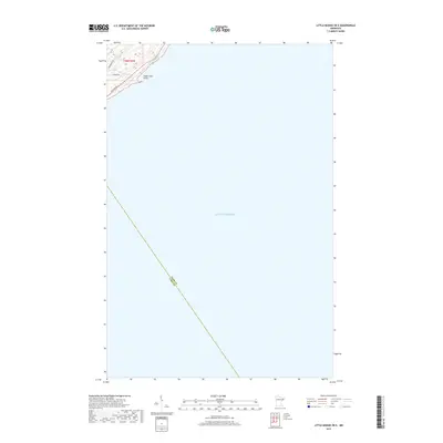
Lake Superior dominates this coastal survey, where the terrestrial landscape is limited to the shoreline of Cook and Lake counties. The small portion of land captured in the northwest corner, situated within Township 58 North, Range 5 West, centers on the distinct protrusion of Sugar Loaf Point. This area shows a sparse residential or seasonal road network including Sugarloaf Rd, Sunrise Dr, and Division Rd, which suggest a quiet shoreline development. The map primarily documents the aquatic expanse and the precise county boundary line extending deep into the lake, marking the maritime intersection of these two Minnesota jurisdictions.
Find a feature on this map
7 named features on this map. Tap any name to fly to it.
Don’t see what you’re looking for? This feature index may not catch every label — zoom into the map to look around manually.
Map Details
Editions of this 2019 Little Marais OE E Map
This is the sole edition of this map. No revisions or reprints were ever made.
Other maps of this area

1954 · Two Harbors
USGS Topo · 1:250,000

1955 · Tofte
USGS Topo · 1:24,000

1955 · Schroeder
USGS Topo · 1:24,000

1955 · Tofte
USGS Topo · 1:62,500

1955 · Cramer
USGS Topo · 1:62,500

1956 · Little Marais
USGS Topo · 1:24,000

1956 · Finland
USGS Topo · 1:62,500

1957 · Two Harbors
USGS Topo · 1:250,000

1958 · Two Harbors
USGS Topo · 1:250,000

1964 · Two Harbors
USGS Topo · 1:250,000