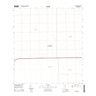
2015 Map of Little Marsh
USGS Topo · Published 2015About this map
Big Cypress National Preserve defines this portion of the Florida interior, where the landscape is a mosaic of wetlands and seasonal watercourses. The 2015 data illustrates the hydrology of the region, featuring the Little Marsh and the slow-moving waters of Mullet Slough. A singular terrestrial landmark, Charlie Fewl Hammock, rises above the surrounding wet prairies, representing the kind of elevated hardwood habitat essential for biodiversity and historical human transit in the Everglades ecosystem. This modern survey provides a clear view of the transportation corridor where Interstate 75 and State Road 84 cut across the preserve, contrasting the engineered infrastructure with the primitive drainage patterns of the Florida swamp.
Find a feature on this map
8 named features on this map. Tap any name to fly to it.
Don’t see what you’re looking for? This feature index may not catch every label — zoom into the map to look around manually.
Map Details
Editions of this 2015 Little Marsh Map
This is the sole edition of this map. No revisions or reprints were ever made.
Other maps of this area

1956 · West Palm Beach
USGS Topo · 1:250,000

1957 · West Palm Beach
USGS Topo · 1:250,000

1958 · West Palm Beach
USGS Topo · 1:250,000

1958 · Sunniland
USGS Topo · 1:24,000

1959 · Miles City
USGS Topo · 1:24,000

1959 · Deep Lake
USGS Topo · 1:24,000

1974 · Immokalee 4 NW
USGS Topo · 1:24,000

1974 · Immokalee 1 SW
USGS Topo · 1:24,000

1974 · Immokalee 1 SE
USGS Topo · 1:24,000
1974 · Immokalee 4 SW
USGS Topo · 1:24,000