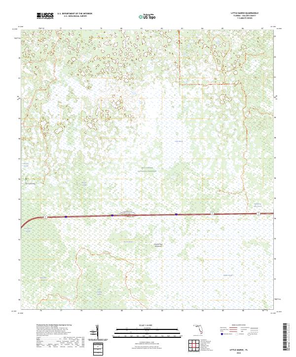
2024 Map of Little Marsh
USGS Topo · Published 2024About this map
The Big Cypress National Preserve dominates this landscape, showing a complex network of wetlands and subtropical features in Collier County. The geography is defined by strands—linear swamp forests—including Harold Strand, East Hinson Strand, and the Deep Lake Strand. These features, along with names like Charlie Fewl Hammock and Baxter Island, reflect the traditional naming conventions of the Everglades region. Transportation through this interior wetland is limited to historical tracks such as Concho Billie Trl, Windmill Trl, and the Harold Strand Trl. The map illustrates the hydrology of the area, centered on the titular Little Marsh and the Kissimmee Billy Strand. This survey provides a precise modern look at the public land divisions and preserved natural features that characterize the Florida Big Cypress interior.
Find a feature on this map
19 named features on this map. Tap any name to fly to it.
Don’t see what you’re looking for? This feature index may not catch every label — zoom into the map to look around manually.
Map Details
Editions of this 2024 Little Marsh Map
This is the sole edition of this map. No revisions or reprints were ever made.
Other maps of this area

1956 · West Palm Beach
USGS Topo · 1:250,000

1957 · West Palm Beach
USGS Topo · 1:250,000

1958 · West Palm Beach
USGS Topo · 1:250,000

1958 · Sunniland
USGS Topo · 1:24,000

1959 · Miles City
USGS Topo · 1:24,000

1959 · Deep Lake
USGS Topo · 1:24,000

1974 · Immokalee 4 NW
USGS Topo · 1:24,000

1974 · Immokalee 1 SW
USGS Topo · 1:24,000

1974 · Immokalee 1 SE
USGS Topo · 1:24,000
1974 · Immokalee 4 SW
USGS Topo · 1:24,000