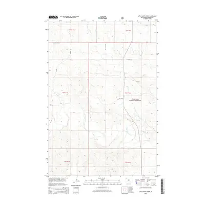
2015 Map of Little Nasty Creek
USGS Topo · Published 2015About this map
The Grand River National Grassland dominates this portion of Perkins County, where the South Fork Grand River cuts a winding path through the northern plains. This landscape is defined by its drainage network, including the namesake Little Nasty Cr and smaller tributaries like Duck Cr and Murphy Cr. The terrain is punctuated by significant elevations such as Pinnacle, providing a vertical contrast to the surrounding plains.
Find a feature on this map
20 named features on this map. Tap any name to fly to it.
Don’t see what you’re looking for? This feature index may not catch every label — zoom into the map to look around manually.
Map Details
Editions of this 2015 Little Nasty Creek Map
This is the sole edition of this map. No revisions or reprints were ever made.
Other maps of this area

1954 · Lemmon
USGS Topo · 1:250,000

1957 · Lemmon
USGS Topo · 1:250,000

1983 · Grandmas Butte
USGS Topo · 1:24,000

1983 · Cow Butte SE
USGS Topo · 1:24,000

1983 · Lodgepole SE
USGS Topo · 1:24,000

1983 · Prairie City NE
USGS Topo · 1:24,000

1983 · Square Top Butte
USGS Topo · 1:24,000

1983 · Cole Dam
USGS Topo · 1:24,000

1983 · Little Nasty Creek
USGS Topo · 1:24,000
1983 · Prairie City
USGS Topo · 1:24,000