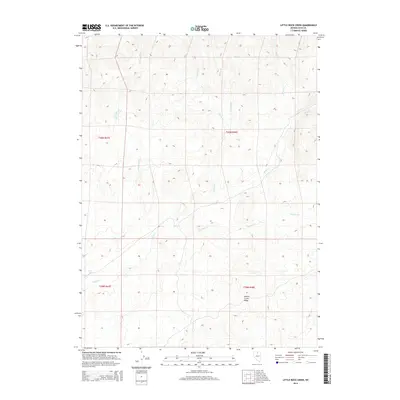
2014 Map of Little Rock Creek
USGS Topo · Published 2014About this map
Hot Springs bubble up in the southwestern corner of this high-desert landscape, where a dense network of seasonal drainages converges. The drainage pattern here is particularly intricate, with Little Rock Cr, Coyote Cr, and Soldier Cr all flowing south toward the larger Rock Cr. This area of Elko County is defined by its water-carved geography, most notably where Toe Jam Cr cuts through the terrain below the prominent Willow Creek Ridge. The map details a region dominated by public land management, where township and range lines like t40n r48e provide the only formal structure across the open range. Researchers will find a landscape that remains largely undeveloped, preserving the original watercourses and topographical contours that have dictated movement through this part of Nevada for generations.
Find a feature on this map
12 named features on this map. Tap any name to fly to it.
Don’t see what you’re looking for? This feature index may not catch every label — zoom into the map to look around manually.
Map Details
Editions of this 2014 Little Rock Creek Map
This is the sole edition of this map. No revisions or reprints were ever made.
Other maps of this area

1955 · McDermitt
USGS Topo · 1:250,000

1956 · Mt. Blitzen
USGS Topo · 1:62,500

1959 · McDermitt
USGS Topo · 1:250,000

1965 · Willow Creek Reservoir
USGS Topo · 1:24,000

1965 · Squaw Valley Ranch
USGS Topo · 1:24,000
1970 · China Camp
USGS Topo · 1:24,000

1973 · Little Rock Creek
USGS Topo · 1:24,000

1974 · Soldier Cap
USGS Topo · 1:24,000

1974 · Burner Hills
USGS Topo · 1:24,000

1977 · Scraper Springs
USGS Topo · 1:24,000