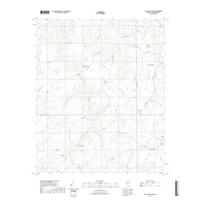
2018 Map of Little Sand Creek
USGS Topo · Published 2018About this map
Calabrella Creek and Wolf Creek define the drainage of this Webster County landscape, where family burial grounds and winding rural roads trace the history of local settlement. The eastern edge of the map features the proximity of Old Greenboro Cemetery and Greenboro Cemetery, points of interest for genealogists researching the early communities of north-central Mississippi. A network of country lanes, including Gold Mine Road, Union Church Road, and Mount Vernon Road, connects scattered homesteads and landmarks like the Edward Springs Cemetery and Macedonia Cemetery. The topography is marked by numerous small tributaries such as Patts Branch and Yates Creek, illustrating the complex creek systems that influenced the placement of original homesteads and local roads in the region.
Find a feature on this map
29 named features on this map. Tap any name to fly to it.
Don’t see what you’re looking for? This feature index may not catch every label — zoom into the map to look around manually.
Map Details
Editions of this 2018 Little Sand Creek Map
This is the sole edition of this map. No revisions or reprints were ever made.
Other maps of this area

1953 · Walthall
USGS Topo · 1:62,500

1953 · West Point
USGS Topo · 1:250,000

1954 · Duck Hill
USGS Topo · 1:62,500

1958 · West Point
USGS Topo · 1:250,000

1963 · West Point
USGS Topo · 1:250,000

1966 · Kilmichael
USGS Topo · 1:24,000

1966 · Stewart
USGS Topo · 1:24,000

1966 · Tomnolen
USGS Topo · 1:24,000

1968 · Weir
USGS Topo · 1:62,500

1968 · Winona
USGS Topo · 1:62,500