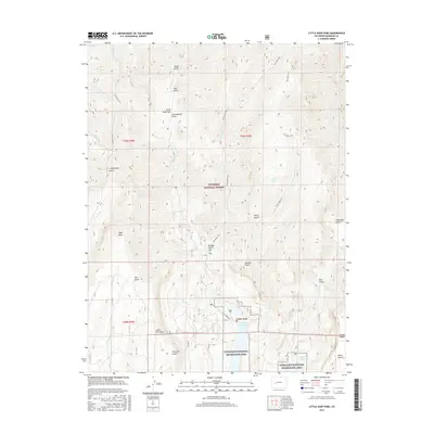
2016 Map of Little Soap Park
USGS Topo · Published 2016About this map
Gunnison National Forest dominates this landscape, where the high mesa country of Soap Mesa and Dillon Mesa meets the northern reaches of the Curecanti National Recreation Area. The terrain is deeply incised by a network of gulches and creeks, including Mill Gulch and Curecanti Cr, which drain toward the vast Blue Mesa Reservoir in the south. This 2016 survey illustrates a high-altitude wilderness defined by its drainage patterns and back-country access. Historic routes like the Curecanti Trail, Cow Creek Trail, and Coal Mesa Trail provide the primary means of navigating the steep transitions between parks like Little Soap Park and the prominent heights of Pearson Point. The area around Oregon Gulch shows the managed boundary between national forest lands and recreation zones, reflecting the modern conservation and hydraulic character of the Gunnison River basin.
Find a feature on this map
42 named features on this map. Tap any name to fly to it.
Don’t see what you’re looking for? This feature index may not catch every label — zoom into the map to look around manually.
Map Details
Editions of this 2016 Little Soap Park Map
This is the sole edition of this map. No revisions or reprints were ever made.
Other maps of this area

1908 · Uncompahgre
USGS Topo · 1:125,000

1911 · Uncompahgre
USGS Topo · 1:125,000

1954 · West Elk Peak SW
USGS Topo · 1:24,000

1954 · Little Soap Park
USGS Topo · 1:24,000

1954 · Cebolla
USGS Topo · 1:24,000

1954 · Sapinero
USGS Topo · 1:24,000

1956 · Curecanti Needle
USGS Topo · 1:24,000

1956 · Montrose
USGS Topo · 1:250,000

1957 · X Lazy F Ranch
USGS Topo · 1:24,000

1959 · Montrose
USGS Topo · 1:250,000