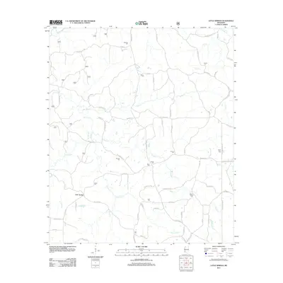
2012 Map of Little Springs
USGS Topo · Published 2012About this map
Little Springs serves as the primary focal point of this 2012 survey, situated within a landscape defined by an intricate network of creeks and family-named cemeteries. The drainage pattern is particularly dense, with McGehee Cr, Horse Cr, and the notably named Wactor Mill Cr carving through the terrain. The area's social history is recorded in numerous burial sites such as Ramah Cem, Mount Gilead Cem, and Ebenezer Cem, many of which sit near winding local roads like Burt Jordan Rd and Bill Lofton Rd. The presence of features like Cane Mill Br suggests a history of local industry tied to these watercourses. This map provides genealogists and local historians with a precise record of rural Franklin County, showing how family names like Laird, McCall, and McGehee remain anchored to the physical geography through roads and landmarks.
Find a feature on this map
88 named features on this map. Tap any name to fly to it.
Don’t see what you’re looking for? This feature index may not catch every label — zoom into the map to look around manually.
Map Details
Editions of this 2012 Little Springs Map
This is the sole edition of this map. No revisions or reprints were ever made.
Other maps of this area

1953 · Natchez
USGS Topo · 1:250,000

1956 · Natchez
USGS Topo · 1:250,000

1959 · Natchez
USGS Topo · 1:250,000

1962 · Bude
USGS Topo · 1:62,500

1963 · Union Church
USGS Topo · 1:62,500

1972 · West Lincoln
USGS Topo · 1:24,000

1972 · Smithdale
USGS Topo · 1:24,000

1972 · McCall Creek
USGS Topo · 1:24,000

1972 · Little Springs
USGS Topo · 1:24,000

1972 · Auburn
USGS Topo · 1:24,000