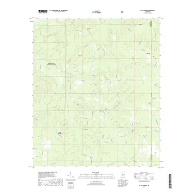
2018 Map of Little Springs
USGS Topo · Published 2018About this map
Little Springs serves as the central point of reference for this pocket of Southwest Mississippi, where the headwaters of numerous creeks carve through the landscape of the Homochitto National Forest. The map is particularly notable for its density of family and community burial grounds, illustrating a deeply rooted rural genealogy. Features like McGehee Cem, McCall Cem, and Ramah Cem are positioned along early ridge-running roads such as Bill Lofton Rd SE and Roundtop Hill Rd. The drainage patterns, including Horse Cr and Goober Cr, reveal the natural contours that dictated the placement of small-scale settlements and religious sites like Ebenezer Cem. Along the eastern border, the Franklin Co Lincoln Co line intersects with Linfrank Line Dr, marking the transition between these two timber-rich counties.
Find a feature on this map
86 named features on this map. Tap any name to fly to it.
Don’t see what you’re looking for? This feature index may not catch every label — zoom into the map to look around manually.
Map Details
Editions of this 2018 Little Springs Map
This is the sole edition of this map. No revisions or reprints were ever made.
Other maps of this area

1953 · Natchez
USGS Topo · 1:250,000

1956 · Natchez
USGS Topo · 1:250,000

1959 · Natchez
USGS Topo · 1:250,000

1962 · Bude
USGS Topo · 1:62,500

1963 · Union Church
USGS Topo · 1:62,500

1972 · West Lincoln
USGS Topo · 1:24,000

1972 · Smithdale
USGS Topo · 1:24,000

1972 · McCall Creek
USGS Topo · 1:24,000

1972 · Little Springs
USGS Topo · 1:24,000

1972 · Auburn
USGS Topo · 1:24,000