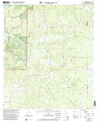
2000 Map of Little Springs
USGS Topo · Published 2002About this map
The Homochitto National Forest encompasses much of this landscape, where the headwaters of the Bogue Chitto river system and Mc Call Creek carve through the terrain. At the turn of the millennium, the small settlement of Little Springs remained a focal point for the surrounding rural community, anchored by family-named landmarks and long-standing country churches. The density of sites like Ebenezer Ch, Ramah Ch, and Mt Gilead Ch suggests a history of dispersed but tight-knit congregations across the hills of Franklin and Lincoln counties. Genealogists will find significant value in the numerous well-documented burial sites throughout the area, including McGenée Cem, Nettles Cem, and Beam Cem. The local economy is reflected in the network of timber roads and scattered Gravel Pits, while names like Tabernacle and Bill Lofton Road preserve the identities of the families who shaped this corner of Mississippi.
Find a feature on this map
49 named features on this map. Tap any name to fly to it.
Don’t see what you’re looking for? This feature index may not catch every label — zoom into the map to look around manually.
Map Details
Editions of this 2000 Little Springs Map
This is the sole edition of this map. No revisions or reprints were ever made.
Other maps of this area

1953 · Natchez
USGS Topo · 1:250,000

1956 · Natchez
USGS Topo · 1:250,000

1959 · Natchez
USGS Topo · 1:250,000

1962 · Bude
USGS Topo · 1:62,500

1963 · Union Church
USGS Topo · 1:62,500

1972 · West Lincoln
USGS Topo · 1:24,000

1972 · Smithdale
USGS Topo · 1:24,000

1972 · McCall Creek
USGS Topo · 1:24,000

1972 · Little Springs
USGS Topo · 1:24,000

1972 · Auburn
USGS Topo · 1:24,000