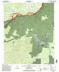
1994 Map of Little Switzerland
USGS Topo · Published 1998About this map
Little Switzerland serves as the focal point of this 1994 revision, perched along the winding route of the Blue Ridge Parkway. The terrain is defined by the high ridges of the Pisgah National Forest, where the landscape drops sharply from peaks like Rich Knob and Stony Knob toward the valley floors of the North Fork Catawba River. Significant engineering for mountain transport is visible in a dense sequence of railroad tunnels, including the Upper Pine Tunnel, Bird Ridge Tunnel, and Little Switzerland Tunnel, which navigate the complex topography of The Loop.
Find a feature on this map
97 named features on this map. Tap any name to fly to it.
Don’t see what you’re looking for? This feature index may not catch every label — zoom into the map to look around manually.
Map Details
Editions of this 1994 Little Switzerland Map
This is the sole edition of this map. No revisions or reprints were ever made.
Other maps of this area

1900 · Mount Mitchell
USGS Topo · 1:125,000

1902 · Mount Mitchell
USGS Topo · 1:125,000

1905 · Morganton
USGS Topo · 1:125,000

1934 · Micaville
USGS Topo · 1:24,000

1934 · Spruce Pine
USGS Topo · 1:24,000

1934 · Parts Of Celo And Black Brothers
USGS Topo · 1:24,000

1934 · Parts Of Old Fort and Montreat
USGS Topo · 1:24,000

1934 · Linville Falls
USGS Topo · 1:24,000

1953 · Charlotte
USGS Topo · 1:250,000

1954 · Charlotte
USGS Topo · 1:250,000