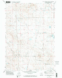
1971 Map of Little Thunder Reservoir
USGS Topo · Published 1974About this map
Little Thunder Creek and its many seasonal tributaries, including Dry Fork Little Thunder Creek and Cripple Creek, define this portion of Campbell County during the early 1970s. The landscape is characterized by high plains drainage patterns and distinct volcanic or erosional features like Black Butte and Gray Butte. Human activity is centered around the Reno County Road and the ranching operations typical of the Powder River Basin, evidenced by the Stuart Ranch and several gravel pits used for local road maintenance.
Find a feature on this map
21 named features on this map. Tap any name to fly to it.
Don’t see what you’re looking for? This feature index may not catch every label — zoom into the map to look around manually.
Map Details
Editions of this 1971 Little Thunder Reservoir Map
2 editions found
Other maps of this area

1955 · Newcastle
USGS Topo · 1:250,000

1958 · Newcastle
USGS Topo · 1:250,000

1959 · North Star School
USGS Topo · 1:62,500

1960 · Turnercrest
USGS Topo · 1:62,500

1971 · Teckla
USGS Topo · 1:24,000

1971 · Reno Junction
USGS Topo · 1:24,000

1971 · Reno Reservoir
USGS Topo · 1:24,000

1971 · Little Thunder Reservoir
USGS Topo · 1:24,000

1971 · Teckla SW
USGS Topo · 1:24,000
1971 · Hilight
USGS Topo · 1:24,000