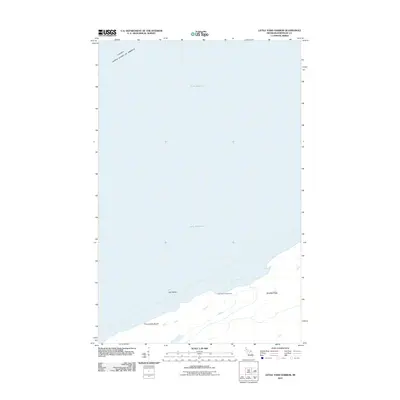
2011 Map of Little Todd Harbor
USGS Topo · Published 2011About this map
Lake Superior dominates the northern reaches of this coastal survey, where the international boundary between Canada and the United States of America cuts across the open water. Along the shoreline, the topography is defined by the prominent Minong Ridge, which runs parallel to the coast and overlooks sheltered waters like Todd Cove and the namesake Little Todd Harbor. The map highlights a localized coastal landscape of rocky outcroppings and specific shoreline features including Gull Rocks and Thomsonite Beach. A single point of human infrastructure, the Little Todd Campground, is noted along the harbor, illustrating the area's primary role as a site for seasonal outdoor recreation and maritime navigation rather than permanent settlement.
Find a feature on this map
8 named features on this map. Tap any name to fly to it.
Don’t see what you’re looking for? This feature index may not catch every label — zoom into the map to look around manually.
Map Details
Editions of this 2011 Little Todd Harbor Map
This is the sole edition of this map. No revisions or reprints were ever made.
Other maps of this area

1958 · Hancock
USGS Topo · 1:250,000

1959 · Fort William
USGS Topo · 1:250,000

1960 · Hancock
USGS Topo · 1:250,000

1961 · Hancock
USGS Topo · 1:250,000

1966 · Hancock
USGS Topo · 1:250,000

1968 · Fort William
USGS Topo · 1:250,000

1985 · Todd Harbor
USGS Topo · 1:100,000

1985 · Pigeon Point
USGS Topo · 1:100,000

1985 · Siskiwit Bay
USGS Topo · 1:100,000

1985 · Grand Portage
USGS Topo · 1:100,000