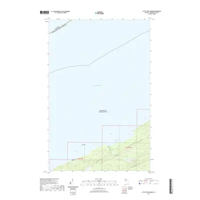
2019 Map of Little Todd Harbor
USGS Topo · Published 2019About this map
Isle Royale National Park dominates this portion of the Lake Superior wilderness, where the island's characteristic linear ridges define the landscape. The northern coastline is marked by the sheltered waters of Little Todd Harbor and the smaller Todd Cove, with Gull Rocks lying just offshore in Lake Superior. A clear maritime boundary marks the international line between Canada and the United States of America, running through the open water north of the island.
Find a feature on this map
15 named features on this map. Tap any name to fly to it.
Don’t see what you’re looking for? This feature index may not catch every label — zoom into the map to look around manually.
Map Details
Editions of this 2019 Little Todd Harbor Map
This is the sole edition of this map. No revisions or reprints were ever made.
Other maps of this area

1958 · Hancock
USGS Topo · 1:250,000

1959 · Fort William
USGS Topo · 1:250,000

1960 · Hancock
USGS Topo · 1:250,000

1961 · Hancock
USGS Topo · 1:250,000

1966 · Hancock
USGS Topo · 1:250,000

1968 · Fort William
USGS Topo · 1:250,000

1985 · Todd Harbor
USGS Topo · 1:100,000

1985 · Pigeon Point
USGS Topo · 1:100,000

1985 · Siskiwit Bay
USGS Topo · 1:100,000

1985 · Grand Portage
USGS Topo · 1:100,000