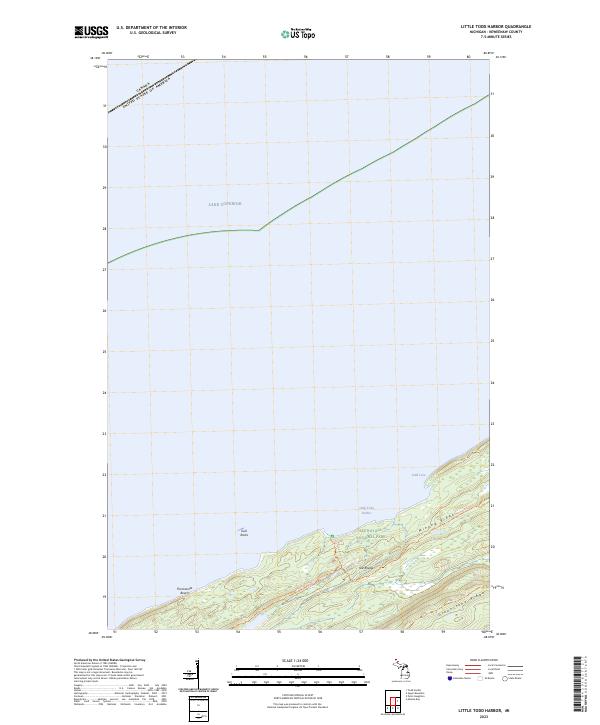
2023 Map of Little Todd Harbor
USGS Topo · Published 2023About this map
Isle Royale stands as a primitive landscape defined by its remote location in Lake Superior. This survey detail focuses on the northwestern shoreline, where the land rises sharply from the water's edge into parallel volcanic backbones. Isle Royale National Park preserves this environment, which is deeply marked by the distinct elevations of Minong Ridge and the more inland Greenstone Ridge. These geological formations dictate the movement of anyone navigating the island, as seen with the Minong Ridge Trl following the high ground.
Find a feature on this map
15 named features on this map. Tap any name to fly to it.
Don’t see what you’re looking for? This feature index may not catch every label — zoom into the map to look around manually.
Map Details
Editions of this 2023 Little Todd Harbor Map
This is the sole edition of this map. No revisions or reprints were ever made.
Other maps of this area

1958 · Hancock
USGS Topo · 1:250,000

1959 · Fort William
USGS Topo · 1:250,000

1960 · Hancock
USGS Topo · 1:250,000

1961 · Hancock
USGS Topo · 1:250,000

1966 · Hancock
USGS Topo · 1:250,000

1968 · Fort William
USGS Topo · 1:250,000

1985 · Todd Harbor
USGS Topo · 1:100,000

1985 · Pigeon Point
USGS Topo · 1:100,000

1985 · Siskiwit Bay
USGS Topo · 1:100,000

1985 · Grand Portage
USGS Topo · 1:100,000