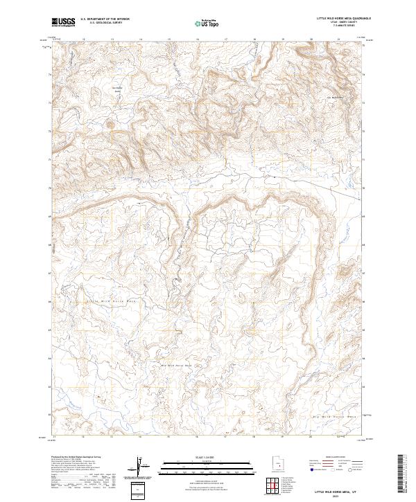
2023 Map of Little Wild Horse Mesa
USGS Topo · Published 2023About this map
The San Rafael Swell and its jagged companion, the San Rafael Reef, dominate this central Utah landscape, showcasing the dramatic geological uplifting and erosion characteristic of Emery County. The terrain is defined by a series of stepped plateaus, including Little Wild Horse Mesa, Mid Wild Horse Mesa, and Big Wild Horse Mesa, which rise above a network of deep drainages. Human passage through this high-desert environment is largely limited to Wild Horse Rd, providing access to the narrow slots of Little Wild Horse Canyon and Bell Canyon. In the southwest, the perennial flow of Muddy Creek cuts through the desert floor, while the isolated Cistern Canyon Spr highlights the scarcity of water in this arid expanse. The map effectively documents the intersection of these massive geological formations and the natural watercourses like Wild Horse Creek that continue to shape them.
Find a feature on this map
14 named features on this map. Tap any name to fly to it.
Don’t see what you’re looking for? This feature index may not catch every label — zoom into the map to look around manually.
Map Details
Editions of this 2023 Little Wild Horse Mesa Map
This is the sole edition of this map. No revisions or reprints were ever made.
Other maps of this area

1885 · San Rafael
USGS Topo · 1:250,000

1952 · Wild Horse
USGS Topo · 1:62,500

1953 · Temple Mtn
USGS Topo · 1:62,500

1954 · Stinking Springs Creek 4 SW
USGS Topo · 1:24,000

1954 · Stinking Spring Creek 3 NW
USGS Topo · 1:24,000

1954 · Stinking Spring Creek 3 SE
USGS Topo · 1:24,000

1954 · Stinking Spring Creek 4 NW
USGS Topo · 1:24,000

1954 · Stinking Spring Creek 3 SW
USGS Topo · 1:24,000
1954 · Stinking Spring Creek 3 NE
USGS Topo · 1:24,000

1954 · Mt. Ellen 1 NW
USGS Topo · 1:24,000