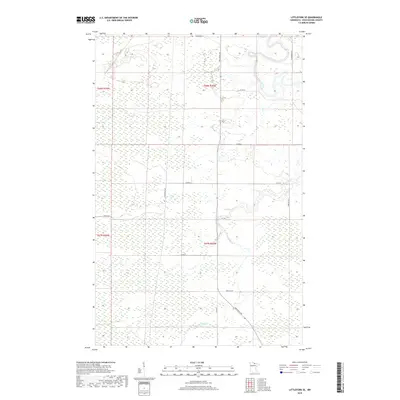
2019 Map of Littlefork SE
USGS Topo · Published 2019About this map
Little Fork River meanders across the northeastern corner of this landscape, its serpentine path defining the drainage patterns of northern Koochiching County. The terrain is characterized by extensive wetlands and drainage networks, with the Cross River flowing through the southern sections. This area, largely defined by its natural hydrology, is segmented by a sparse grid of roads including Town Rd 99 and Co Rd 71. The Deer River Line serves as a prominent north-south boundary marker through the center of the survey. Settlement patterns here are lean, with transportation routes like Industrial Ave and Wisner Trl providing the primary access points into the dense interior. The map illustrates a region where the natural environment and township lines remain the dominant features over built infrastructure.
Find a feature on this map
20 named features on this map. Tap any name to fly to it.
Don’t see what you’re looking for? This feature index may not catch every label — zoom into the map to look around manually.
Map Details
Editions of this 2019 Littlefork SE Map
This is the sole edition of this map. No revisions or reprints were ever made.
Other maps of this area

1919 · Happy Land
USGS Topo · 1:62,500

1919 · M
USGS Topo · 1:62,500

1954 · International Falls
USGS Topo · 1:250,000

1957 · International Falls
USGS Topo · 1:250,000

1958 · International Falls
USGS Topo · 1:250,000

1969 · Ericsburg NW
USGS Topo · 1:24,000

1969 · Ericsburg SW
USGS Topo · 1:24,000

1970 · Littlefork SE
USGS Topo · 1:24,000
1970 · Littlefork
USGS Topo · 1:24,000

1970 · Littlefork SW
USGS Topo · 1:24,000