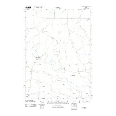
2010 Map of Littleport
USGS Topo · Published 2010About this map
Motor Mill stands as a prominent landmark on the Turkey River, where its historical industrial presence is marked by the Motor Mill Bridge and dedicated Motor Mill Access. This Clayton County landscape is defined by the winding paths of the Turkey and Volga River, which frame several small settlements including Communia and Littleport. The mapping shows a significant density of family and community burial sites, such as Union Cemetery, Meenan Cemetery, and Eberhard Cemetery, offering a detailed spatial record for genealogical research. Local civic life is anchored by the Clayton County Fairgrounds and the Littleport Post Office. The terrain is cut by numerous drainages like Panther Creek and Bente Branch, leading into named valleys such as Fine Hollow and Beddows Hollow.
Find a feature on this map
54 named features on this map. Tap any name to fly to it.
Don’t see what you’re looking for? This feature index may not catch every label — zoom into the map to look around manually.
Map Details
Editions of this 2010 Littleport Map
This is the sole edition of this map. No revisions or reprints were ever made.
Other maps of this area

1902 · Elkader
USGS Topo · 1:125,000

1957 · Colesburg
USGS Topo · 1:24,000

1959 · Dubuque
USGS Topo · 1:250,000

1961 · Dubuque
USGS Topo · 1:250,000

1962 · Dubuque
USGS Topo · 1:250,000

1962 · Clayton
USGS Topo · 1:24,000
1962 · Garnavillo
USGS Topo · 1:24,000
1964 · Littleport
USGS Topo · 1:24,000

1964 · Edgewood
USGS Topo · 1:24,000

1964 · Garber
USGS Topo · 1:24,000