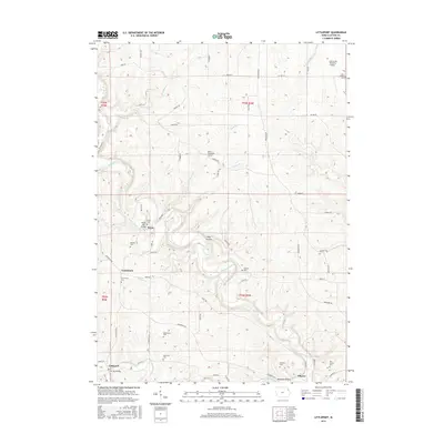
2015 Map of Littleport
USGS Topo · Published 2015About this map
The Turkey River and Volga River wind through this corner of Clayton County, carving a landscape marked by deep incisions like Pine Hollow and Beddows Hollow. These waterways dictated the placement of early settlements, including Littleport, Elkport, and Communia, where traditional gridded road systems give way to the winding paths of the river valleys. The northern reaches of the map feature distinctive civil engineering landmarks such as the Motor Mill Bridge and the Garnavillo Township Culvert, reflecting the region's agricultural infrastructure.
Find a feature on this map
63 named features on this map. Tap any name to fly to it.
Don’t see what you’re looking for? This feature index may not catch every label — zoom into the map to look around manually.
Map Details
Editions of this 2015 Littleport Map
This is the sole edition of this map. No revisions or reprints were ever made.
Other maps of this area

1902 · Elkader
USGS Topo · 1:125,000

1957 · Colesburg
USGS Topo · 1:24,000

1959 · Dubuque
USGS Topo · 1:250,000

1961 · Dubuque
USGS Topo · 1:250,000

1962 · Dubuque
USGS Topo · 1:250,000

1962 · Clayton
USGS Topo · 1:24,000
1962 · Garnavillo
USGS Topo · 1:24,000
1964 · Littleport
USGS Topo · 1:24,000

1964 · Edgewood
USGS Topo · 1:24,000

1964 · Garber
USGS Topo · 1:24,000