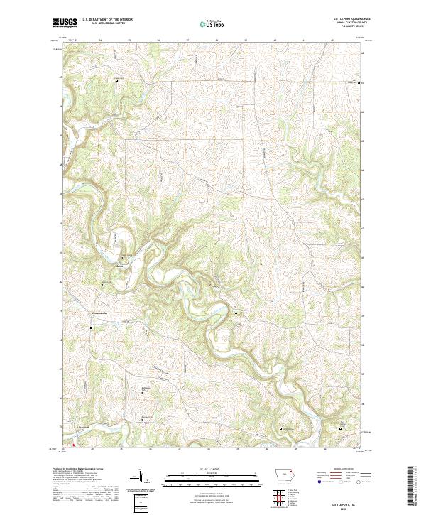
2022 Map of Littleport
USGS Topo · Published 2022About this map
Littleport and the Volga River valley anchor this Clayton County survey, showing a landscape defined by the winding paths of the Turkey River and its numerous tributaries. The map reveals a dense network of country cemeteries, such as Blanchaine Cem and Eberhard Cem, which dot the uplands and hollows, often far from the primary settlements. The small communities of Communia and Motor are preserved here alongside topographical features like Pine Hollow and Beddows Hollow. These labels suggest a pattern of early German settlement and agricultural development that utilized the protected lowlands for homesteading while maintaining small burial grounds on family plots or parish lands. Modern infrastructure, including the Pony Hollow Trl and a grid of rural routes like Hazel Rd and Granite Ave, illustrates how contemporary access has overlaid the 19th-century river-and-rail economy.
Find a feature on this map
60 named features on this map. Tap any name to fly to it.
Don’t see what you’re looking for? This feature index may not catch every label — zoom into the map to look around manually.
Map Details
Editions of this 2022 Littleport Map
This is the sole edition of this map. No revisions or reprints were ever made.
Other maps of this area

1902 · Elkader
USGS Topo · 1:125,000

1957 · Colesburg
USGS Topo · 1:24,000

1959 · Dubuque
USGS Topo · 1:250,000

1961 · Dubuque
USGS Topo · 1:250,000

1962 · Dubuque
USGS Topo · 1:250,000

1962 · Clayton
USGS Topo · 1:24,000
1962 · Garnavillo
USGS Topo · 1:24,000
1964 · Littleport
USGS Topo · 1:24,000

1964 · Edgewood
USGS Topo · 1:24,000

1964 · Garber
USGS Topo · 1:24,000