
1932 Map of Littleton
USGS Topo · Published 1932About this map
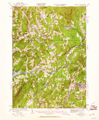
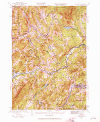
Kirby Mtn Quarries anchor the northern hills of this landscape, reflecting the region's industrial heritage at the start of the 1930s. The area is defined by the winding course of the Moose River and the Connecticut River, which forms the border between Vermont and New Hampshire. This survey documents a high density of rural schoolhouses, from Pierce Mill Sch on the western edge to the Texas Sch in the east, providing a detailed spatial record for genealogists tracing family roots in Caledonia Co and Essex Co.
Find a feature on this map
69 named features on this map. Tap any name to fly to it.
Don’t see what you’re looking for? This feature index may not catch every label — zoom into the map to look around manually.
Map Details
Editions of this 1932 Littleton Map
3 editions found
Other maps of this area

1900 · Whitefield
USGS Topo · 1:62,500

1920 · Guildhall
USGS Topo · 1:62,500

1929 · Moosilauke
USGS Topo · 1:62,500

1929 · Franconia
USGS Topo · 1:62,500

1931 · Guildhall
USGS Topo · 1:48,000

1931 · Littleton
USGS Topo · 1:62,500

1931 · Woodsville
USGS Topo · 1:48,000

1932 · Franconia
USGS Topo · 1:62,500

1932 · Moosilauke
USGS Topo · 1:62,500

1933 · Guildhall
USGS Topo · 1:48,000