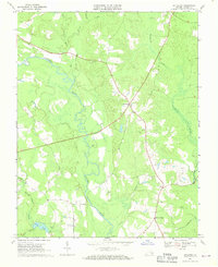
1968 Map of Littleton
USGS Topo · Published 1970About this map
The Nottoway River meanders through this landscape of southeast Virginia, defining a terrain dominated by extensive wetlands and small crossroads communities. Settlements like Homeville, Littleton, and Barretts Store serve as focal points for a rural area where the economy appears tied to the land, evidenced by several Gravel Pits and the historic Plank Road. Local genealogy is well-represented through numerous rural congregations, including Plank Road Ch, Easter Ch, and Oak Grove Ch, alongside scattered family and community cemeteries.
Find a feature on this map
23 named features on this map. Tap any name to fly to it.
Don’t see what you’re looking for? This feature index may not catch every label — zoom into the map to look around manually.
Map Details
Editions of this 1968 Littleton Map
2 editions found
Other maps of this area

1894 · Petersburg
USGS Topo · 1:62,500

1919 · Jarratt
USGS Topo · 1:62,500

1919 · Disputanta
USGS Topo · 1:62,500

1919 · Homeville
USGS Topo · 1:48,000

1920 · Homeville
USGS Topo · 1:62,500

1943 · Sebrell
USGS Topo · 1:31,680

1943 · Manry
USGS Topo · 1:31,680

1943 · Littleton
USGS Topo · 1:31,680

1943 · Vicksville
USGS Topo · 1:31,680

1943 · Richmond
USGS Topo · 1:250,000