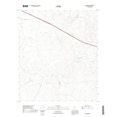
2019 Map of Live Oak Draw
USGS Topo · Published 2019About this map
The Fort Terrett Ranch area of Sutton County is defined by its network of ephemeral drainage systems and established family ranching operations. The terrain is deeply incised by the Live Oak Draw, Eightmile Draw, and Tenmile Draw, which all contribute to the N Llano River watershed. Water management in this semi-arid environment is evidenced by the named watering points such as Tenmile Waterhole and Eightmile Waterhole, alongside specialized locations like Buffalo Well SW and Buffalo Well SE.
Find a feature on this map
25 named features on this map. Tap any name to fly to it.
Don’t see what you’re looking for? This feature index may not catch every label — zoom into the map to look around manually.
Map Details
Editions of this 2019 Live Oak Draw Map
This is the sole edition of this map. No revisions or reprints were ever made.
Other maps of this area

1893 · Rock Springs
USGS Topo · 1:125,000

1893 · Fort McKavett
USGS Topo · 1:125,000

1954 · Sonora
USGS Topo · 1:250,000

1958 · Sonora
USGS Topo · 1:250,000

1962 · Stewart Ranch
USGS Topo · 1:24,000
1962 · Bundy Ranch
USGS Topo · 1:24,000

1963 · Steen Lake
USGS Topo · 1:24,000

1963 · Harrison Ranch
USGS Topo · 1:24,000

1963 · Live Oak Draw
USGS Topo · 1:24,000

1963 · Buffalo Well SE
USGS Topo · 1:24,000