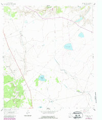
1962 Map of Live Oak Lake
USGS Topo · Published 1987About this map
The San Antonio River defines the northern edge of this south Texas landscape, where vast ranchlands and hydraulic infrastructure tell the story of a working 1960s cattle and oil territory. Cattle ranching is well-established at Fant Ranch and River Ranch, supported by a dense network of water sources including the Dutch Trap Windmill, Old Vat Windmill, and Little Sarco Windmill. The presence of the Sarco Field and numerous cross-cutting Pipeline routes indicates the area's mid-century petroleum development.
Find a feature on this map
23 named features on this map. Tap any name to fly to it.
Don’t see what you’re looking for? This feature index may not catch every label — zoom into the map to look around manually.
Map Details
Editions of this 1962 Live Oak Lake Map
2 editions found
Other maps of this area

1953 · Beeville
USGS Topo · 1:250,000

1954 · Vidaurri
USGS Topo · 1:62,500

1954 · Refugio
USGS Topo · 1:62,500

1956 · Beeville
USGS Topo · 1:250,000

1960 · Beeville
USGS Topo · 1:250,000

1962 · Live Oak Lake
USGS Topo · 1:24,000

1962 · Fannin
USGS Topo · 1:24,000

1962 · Lott Lake
USGS Topo · 1:24,000

1962 · Melo
USGS Topo · 1:24,000

1962 · Hensley Lake
USGS Topo · 1:24,000