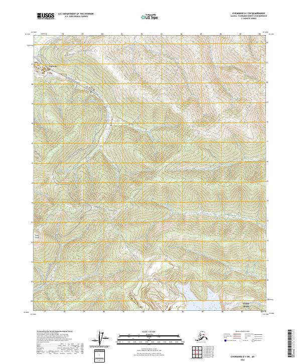
2024 Map of Livengood A-1 SW
USGS Topo · Published 2024About this map
Chatanika and the outlying area of Steele Creek occupy a landscape defined by industrial gold-mining history and modern transit. The Steese Expressway/Highway serves as the primary artery through this interior terrain, linking the creek-cut valleys and high ridges. The presence of the Chatanika Siphon and the extensive road network including Neal Brown Road and Fairbanks Creek Road reflects a long-standing infrastructure built for resource extraction and access.
Find a feature on this map
47 named features on this map. Tap any name to fly to it.
Don’t see what you’re looking for? This feature index may not catch every label — zoom into the map to look around manually.
Map Details
Editions of this 2024 Livengood A-1 SW Map
This is the sole edition of this map. No revisions or reprints were ever made.
Other maps of this area

1945 · Livengood
USGS Topo · 1:250,000

1949 · Fairbanks D-1
USGS Topo · 1:62,500

1949 · Fairbanks D-2
USGS Topo · 1:62,500

1950 · Fairbanks
USGS Topo · 1:250,000

1951 · Fairbanks
USGS Topo · 1:250,000

1951 · Livengood
USGS Topo · 1:250,000

1952 · Fairbanks D-2
USGS Topo · 1:63,360
1952 · Fairbanks D-1
USGS Topo · 1:63,360

1952 · Fairbanks
USGS Topo · 1:250,000

1952 · Livengood A-2
USGS Topo · 1:63,360