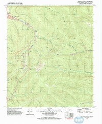
1992 Map of Livengood A-1 SW
USGS Topo · Published 1992About this map
Gold mining history dominates this 1992 edition of the Alaska interior, centering on the high ground of Cleary Summit and Pedro Dome. The map details an intensive landscape of extraction, featuring dozens of Prospect sites and significant operations like the Newsboy Mine, Cleary Hill Mine, and Hi-Yu Mine. Evidence of large-scale hydraulic mining is visible through the Davidson Ditch (Abandoned), an ambitious engineering project designed to move water for washing gold-bearing gravels. Settlement patterns show a shift toward modern infrastructure along the Steese Highway, while earlier mining hubs have faded into history, such as the Cleary (Site) and Golden City (Site). The map also records recreation at the Cleary Summit Lodge and its Ski Lift, alongside traces of early transport like the Winter Trail.
Find a feature on this map
60 named features on this map. Tap any name to fly to it.
Don’t see what you’re looking for? This feature index may not catch every label — zoom into the map to look around manually.
Map Details
Editions of this 1992 Livengood A-1 SW Map
This is the sole edition of this map. No revisions or reprints were ever made.
Other maps of this area

1945 · Livengood
USGS Topo · 1:250,000

1949 · Fairbanks D-1
USGS Topo · 1:62,500

1949 · Fairbanks D-2
USGS Topo · 1:62,500

1950 · Fairbanks
USGS Topo · 1:250,000

1951 · Fairbanks
USGS Topo · 1:250,000

1951 · Livengood
USGS Topo · 1:250,000

1952 · Fairbanks D-2
USGS Topo · 1:63,360
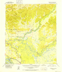
1952 · Fairbanks D-1
USGS Topo · 1:63,360

1952 · Fairbanks
USGS Topo · 1:250,000

1952 · Livengood A-2
USGS Topo · 1:63,360