
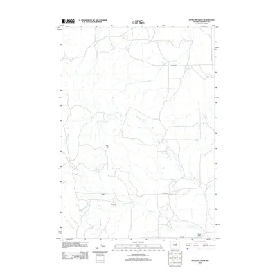
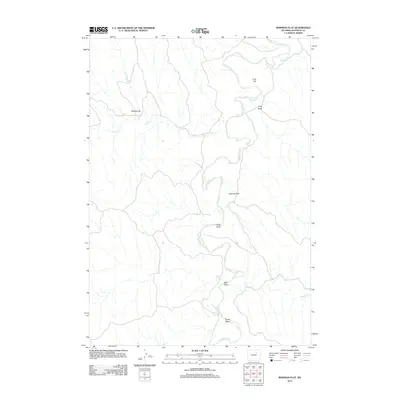
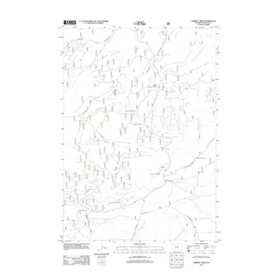
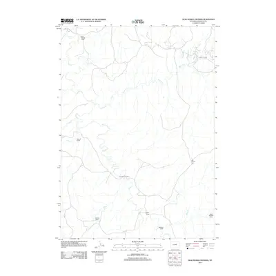
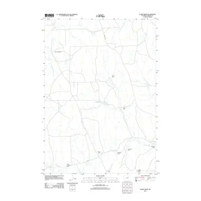
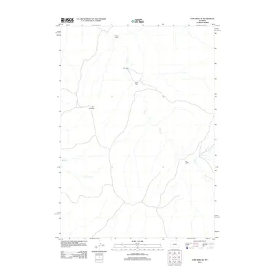
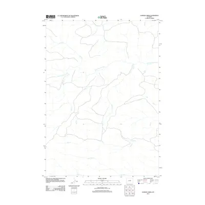
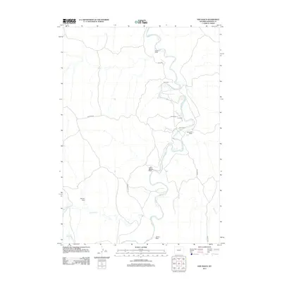
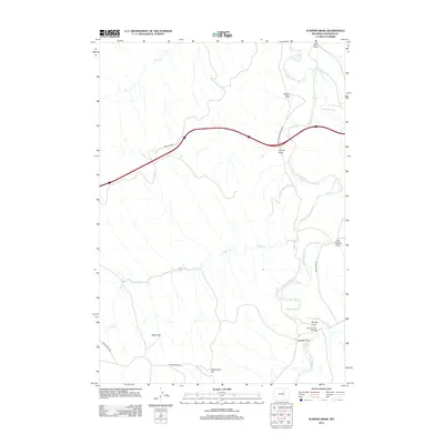
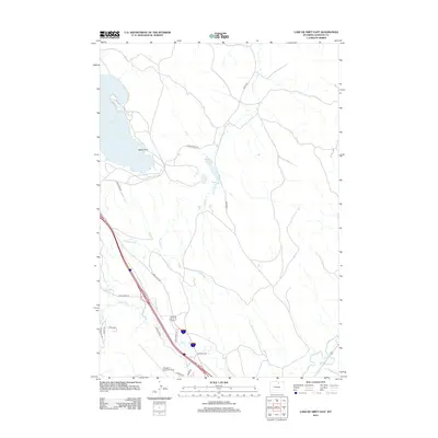
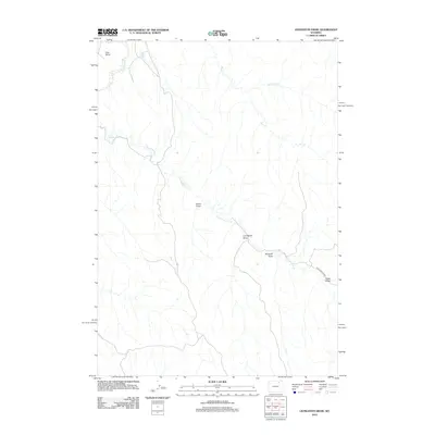
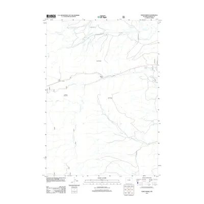
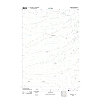
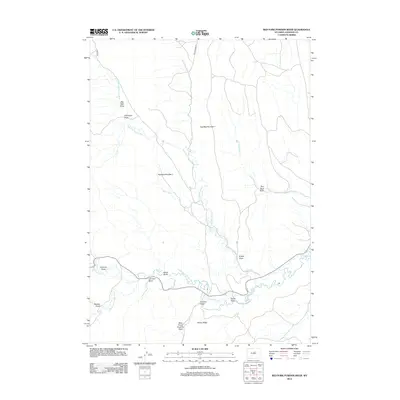
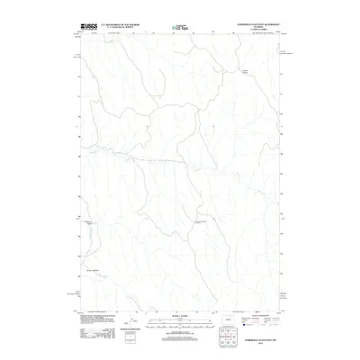
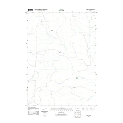
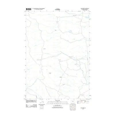
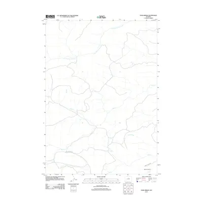
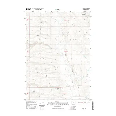
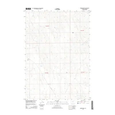
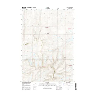
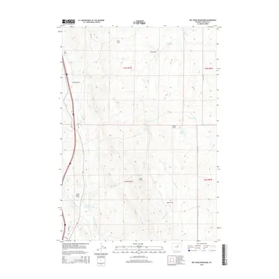
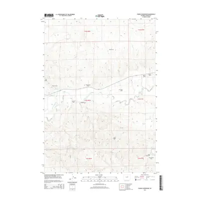
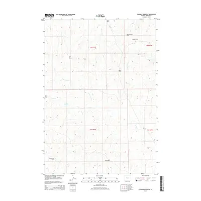
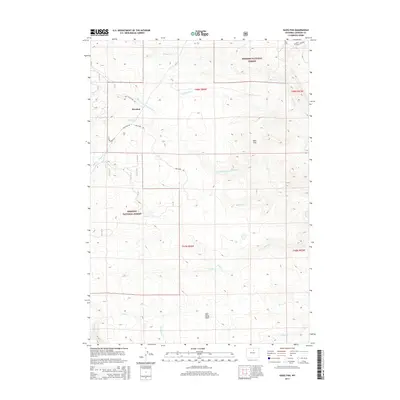
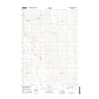
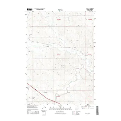
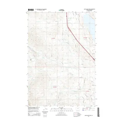
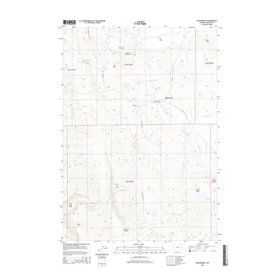
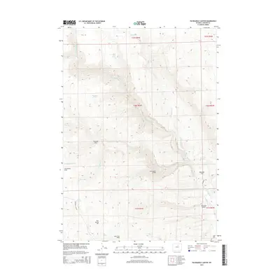
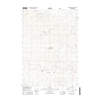
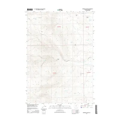
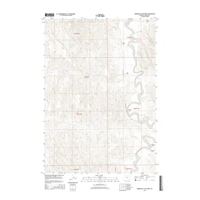
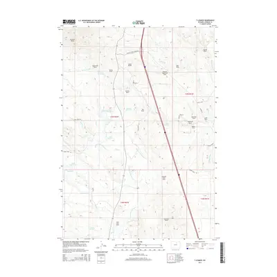
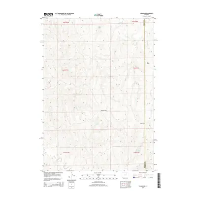
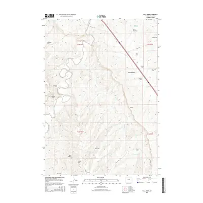
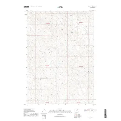
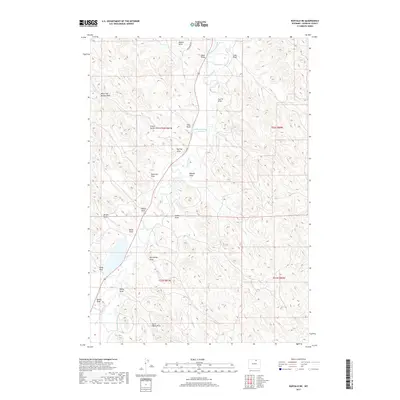
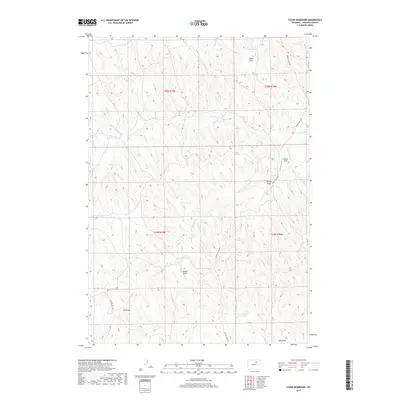
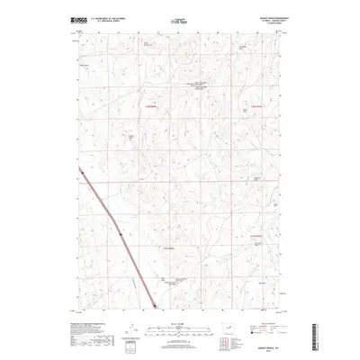
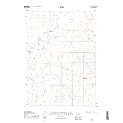
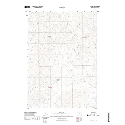
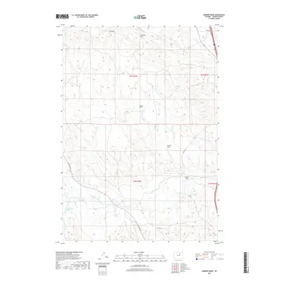
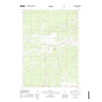
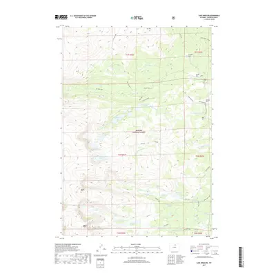
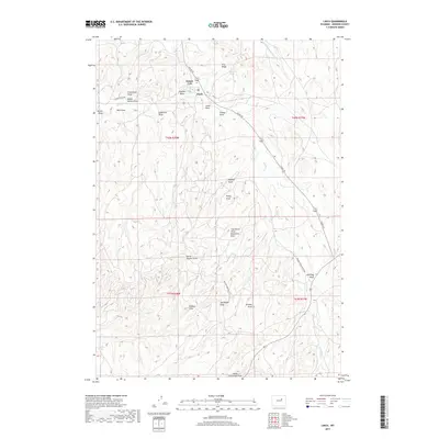
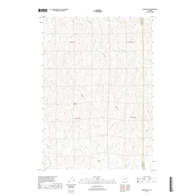
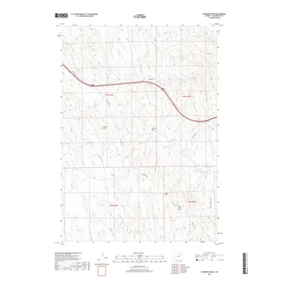
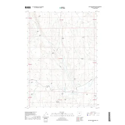
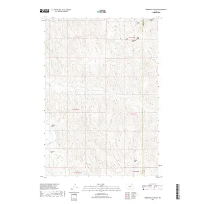
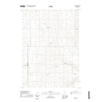
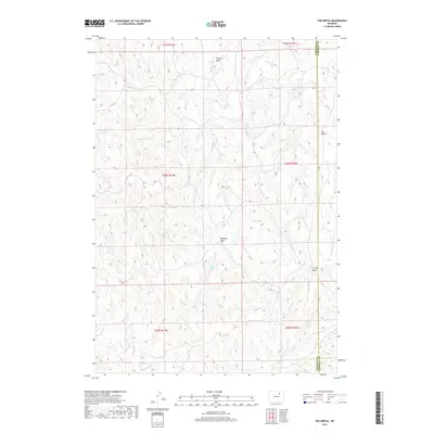
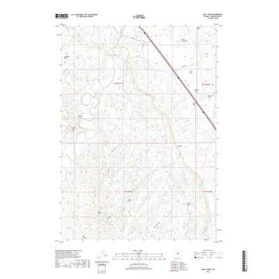
1972 Map of Livingston Draw
USGS Topo · Published 1975About this map
The Powder River carves through the northwestern corner of this Wyoming landscape, marking a stark contrast to the intricate system of draws and seasonal drainages that define the rest of the quadrangle. Straddling the line between Johnson Co and Campbell Co, the terrain is dominated by the Kinney Divide, a prominent ridge separating the watersheds of the river and various tributaries like Fortification Creek and Livingston Draw.
Find a feature on this map
19 named features on this map. Tap any name to fly to it.
Don’t see what you’re looking for? This feature index may not catch every label — zoom into the map to look around manually.
Map Details
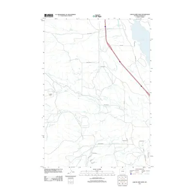
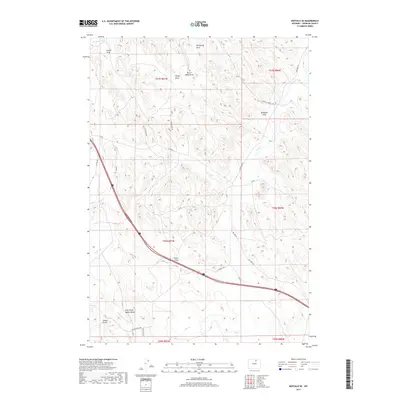
Editions of this 1972 Livingston Draw Map
This is the sole edition of this map. No revisions or reprints were ever made.
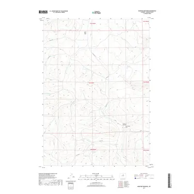
Historical Maps of Campbell County Through Time
370 maps found

1900 Fort McKinney
Johnson County, WY

1903 Fort McKinney
Johnson County, WY

1953 Dry Fork Ranch
Johnson County, WY

1953 Fort Reno
Johnson County, WY

1953 Fort Reno SE
Johnson County, WY

1953 Hoe Ranch
Johnson County, WY

1953 The Nipple
Johnson County, WY

1954 House Creek
Johnson County, WY

1954 Linch
Johnson County, WY

1954 Taylor Ranch
Johnson County, WY

1961 Antelope Draw
Johnson County, WY

1961 Barnum
Johnson County, WY

1961 Dead Woman Crossing
Johnson County, WY

1961 Dry Creek Reservoir
Johnson County, WY

1961 Dugout Ranch
Johnson County, WY

1961 Elaine Draw
Johnson County, WY

1961 Figure 8 Reservoir
Johnson County, WY

1961 Fourmile Reservoir
Johnson County, WY

1961 Hibbard Draw
Johnson County, WY

1961 Kaycee NE
Johnson County, WY

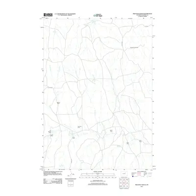
1961 Provence Ranch
Johnson County, WY

1961 Schlicht Draw
Johnson County, WY

1961 Soldier Creek
Johnson County, WY

1961 Sussex
Johnson County, WY

1961 TTT Ranch
Johnson County, WY

1961 Wall Creek
Johnson County, WY

1963 Mayoworth
Johnson County, WY

1967 Beartrap Meadows
Johnson County, WY

1967 Caribou Creek
Johnson County, WY

1967 Cloud Peak
Johnson County, WY

1967 Gordon Creek
Johnson County, WY

1967 Hazelton
Johnson County, WY

1967 Hazelton Peak
Johnson County, WY

1967 Hunter Mesa
Johnson County, WY

1967 Klondike Ranch
Johnson County, WY

1967 Lake Angeline
Johnson County, WY

1967 Lake De Smet West
Johnson County, WY

1967 North Ridge
Johnson County, WY

1967 Powder River Pass
Johnson County, WY

1967 Robinson Canyon
Johnson County, WY

1967 Stone Mountain
Johnson County, WY

1967 Tabletop
Johnson County, WY

1967 Turk Springs
Johnson County, WY

1967 Willow Park Reservoir
Johnson County, WY

1970 Buffalo NE
Johnson County, WY

1970 Buffalo SE
Johnson County, WY

1970 Lake De Smet East
Johnson County, WY

1970 Purdy Reservoir
Johnson County, WY

1970 T A Ranch
Johnson County, WY

1970 Trabing
Johnson County, WY

1972 Bear Draw
Johnson County, WY

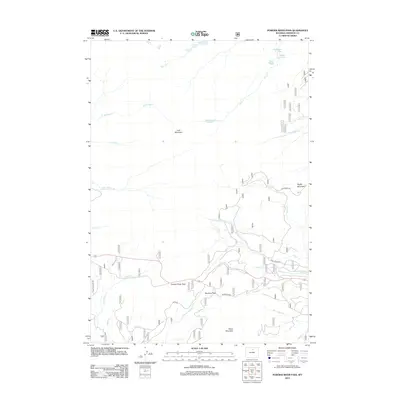
1972 Bowman Flat
Johnson County, WY

1972 Brown Ranch
Johnson County, WY

1972 Coyer Reservoir
Johnson County, WY

1972 Crazy Woman Ranch
Johnson County, WY

1972 Floate Draw
Johnson County, WY

1972 Fredrick Draw
Johnson County, WY

1972 Juniper Draw
Johnson County, WY

1972 Laskie Draw
Johnson County, WY
1972 Livingston Draw
Johnson County, WY

1972 Mitchell Draw
Johnson County, WY

1972 Negro Butte
Johnson County, WY

1972 Pine Gulch
Johnson County, WY

1972 Ploessers Draw
Johnson County, WY

1972 Somerville Flats East
Johnson County, WY

1972 Somerville Flats West
Johnson County, WY

1979 Mayoworth
Johnson County, WY

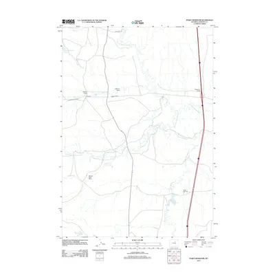
1979 Red Fork Powder River
Johnson County, WY

1981 Antelope Draw
Johnson County, WY

1984 Barnum
Johnson County, WY

1984 Fraker Mountain
Johnson County, WY

1984 Hole-in-the-wall
Johnson County, WY

1984 Packsaddle Canyon
Johnson County, WY

1984 Poker Butte
Johnson County, WY

1984 The Horn
Johnson County, WY

1993 Caribou Creek
Johnson County, WY

1993 Cloud Peak
Johnson County, WY

1993 Hazelton
Johnson County, WY

1993 Hazelton Peak
Johnson County, WY

1993 Hunter Mesa
Johnson County, WY

1993 Klondike Ranch
Johnson County, WY

1993 Lake Angeline
Johnson County, WY

1993 North Ridge
Johnson County, WY

1993 Powder River Pass
Johnson County, WY

1993 Stone Mountain
Johnson County, WY

1993 Willow Park Reservoir
Johnson County, WY
2012 Antelope Draw
Johnson County, WY
2012 Barnum
Johnson County, WY
2012 Bear Draw
Johnson County, WY
2012 Beartrap Meadows
Johnson County, WY
2012 Bowman Flat
Johnson County, WY
2012 Brown Ranch
Johnson County, WY
2012 Buffalo NE
Johnson County, WY
2012 Buffalo SE
Johnson County, WY
2012 Caribou Creek
Johnson County, WY
2012 Cloud Peak
Johnson County, WY
2012 Coyer Reservoir
Johnson County, WY
2012 Crazy Woman Ranch
Johnson County, WY
2012 Dead Woman Crossing
Johnson County, WY
2012 Dry Creek Reservoir
Johnson County, WY
2012 Dry Fork Ranch
Johnson County, WY
2012 Dugout Ranch
Johnson County, WY
2012 Elaine Draw
Johnson County, WY
2012 Figure 8 Reservoir
Johnson County, WY
2012 Floate Draw
Johnson County, WY
2012 Fort Reno
Johnson County, WY
2012 Fort Reno SE
Johnson County, WY
2012 Fourmile Reservoir
Johnson County, WY
2012 Fraker Mountain
Johnson County, WY
2012 Fredrick Draw
Johnson County, WY
2012 Gordon Creek
Johnson County, WY
2012 Hazelton
Johnson County, WY
2012 Hazelton Peak
Johnson County, WY
2012 Hibbard Draw
Johnson County, WY
2012 Hoe Ranch
Johnson County, WY
2012 Hole-in-the-Wall
Johnson County, WY
2012 House Creek
Johnson County, WY
2012 Hunter Mesa
Johnson County, WY
2012 Juniper Draw
Johnson County, WY
2012 Kaycee NE
Johnson County, WY
2012 Klondike Ranch
Johnson County, WY
2012 Lake Angeline
Johnson County, WY
2012 Lake De Smet East
Johnson County, WY
2012 Lake De Smet West
Johnson County, WY
2012 Laskie Draw
Johnson County, WY
2012 Linch
Johnson County, WY
2012 Livingston Draw
Johnson County, WY
2012 Mayoworth
Johnson County, WY
2012 Mitchell Draw
Johnson County, WY
2012 Negro Butte
Johnson County, WY
2012 North Ridge
Johnson County, WY
2012 Packsaddle Canyon
Johnson County, WY
2012 Pine Gulch
Johnson County, WY
2012 Ploessers Draw
Johnson County, WY
2012 Poker Butte
Johnson County, WY
2012 Powder River Pass
Johnson County, WY
2012 Provence Ranch
Johnson County, WY
2012 Purdy Reservoir
Johnson County, WY
2012 Red Fork Powder River
Johnson County, WY
2012 Robinson Canyon
Johnson County, WY
2012 Schlicht Draw
Johnson County, WY
2012 Soldier Creek
Johnson County, WY
2012 Somerville Flats East
Johnson County, WY
2012 Somerville Flats West
Johnson County, WY
2012 Stone Mountain
Johnson County, WY
2012 Sussex
Johnson County, WY
2012 Tabletop
Johnson County, WY
2012 T A Ranch
Johnson County, WY
2012 T A Ranch NE
Johnson County, WY
2012 Taylor Ranch
Johnson County, WY
2012 The Horn
Johnson County, WY
2012 The Nipple
Johnson County, WY
2012 Trabing
Johnson County, WY
2012 TTT Ranch
Johnson County, WY
2012 Turk Springs
Johnson County, WY
2012 Wall Creek
Johnson County, WY
2012 Willow Park Reservoir
Johnson County, WY
2015 Antelope Draw
Johnson County, WY
2015 Barnum
Johnson County, WY
2015 Bear Draw
Johnson County, WY
2015 Beartrap Meadows
Johnson County, WY
2015 Bowman Flat
Johnson County, WY
2015 Brown Ranch
Johnson County, WY
2015 Buffalo NE
Johnson County, WY
2015 Buffalo SE
Johnson County, WY
2015 Caribou Creek
Johnson County, WY
2015 Cloud Peak
Johnson County, WY
2015 Coyer Reservoir
Johnson County, WY
2015 Crazy Woman Ranch
Johnson County, WY
2015 Dead Woman Crossing
Johnson County, WY
2015 Dry Creek Reservoir
Johnson County, WY
2015 Dry Fork Ranch
Johnson County, WY
2015 Dugout Ranch
Johnson County, WY
2015 Elaine Draw
Johnson County, WY
2015 Figure 8 Reservoir
Johnson County, WY
2015 Floate Draw
Johnson County, WY
2015 Fort Reno
Johnson County, WY
2015 Fort Reno SE
Johnson County, WY
2015 Fourmile Reservoir
Johnson County, WY
2015 Fraker Mountain
Johnson County, WY
2015 Fredrick Draw
Johnson County, WY
2015 Gordon Creek
Johnson County, WY
2015 Hazelton
Johnson County, WY
2015 Hazelton Peak
Johnson County, WY
2015 Hibbard Draw
Johnson County, WY
2015 Hoe Ranch
Johnson County, WY
2015 Hole-in-the-Wall
Johnson County, WY
2015 House Creek
Johnson County, WY
2015 Hunter Mesa
Johnson County, WY
2015 Juniper Draw
Johnson County, WY
2015 Kaycee NE
Johnson County, WY
2015 Klondike Ranch
Johnson County, WY
2015 Lake Angeline
Johnson County, WY
2015 Lake De Smet East
Johnson County, WY
2015 Lake De Smet West
Johnson County, WY
2015 Laskie Draw
Johnson County, WY
2015 Linch
Johnson County, WY
2015 Livingston Draw
Johnson County, WY
2015 Mayoworth
Johnson County, WY
2015 Mitchell Draw
Johnson County, WY
2015 Negro Butte
Johnson County, WY
2015 North Ridge
Johnson County, WY
2015 Packsaddle Canyon
Johnson County, WY
2015 Pine Gulch
Johnson County, WY
2015 Ploessers Draw
Johnson County, WY
2015 Poker Butte
Johnson County, WY
2015 Powder River Pass
Johnson County, WY
2015 Provence Ranch
Johnson County, WY
2015 Purdy Reservoir
Johnson County, WY
2015 Red Fork Powder River
Johnson County, WY
2015 Robinson Canyon
Johnson County, WY
2015 Schlicht Draw
Johnson County, WY
2015 Soldier Creek
Johnson County, WY
2015 Somerville Flats East
Johnson County, WY
2015 Somerville Flats West
Johnson County, WY
2015 Stone Mountain
Johnson County, WY
2015 Sussex
Johnson County, WY
2015 Tabletop
Johnson County, WY
2015 T A Ranch
Johnson County, WY
2015 T A Ranch NE
Johnson County, WY
2015 Taylor Ranch
Johnson County, WY
2015 The Horn
Johnson County, WY
2015 The Nipple
Johnson County, WY
2015 Trabing
Johnson County, WY
2015 TTT Ranch
Johnson County, WY
2015 Turk Springs
Johnson County, WY
2015 Wall Creek
Johnson County, WY
2015 Willow Park Reservoir
Johnson County, WY
2017 Antelope Draw
Johnson County, WY
2017 Barnum
Johnson County, WY
2017 Bear Draw
Johnson County, WY
2017 Beartrap Meadows
Johnson County, WY
2017 Bowman Flat
Johnson County, WY
2017 Brown Ranch
Johnson County, WY
2017 Buffalo NE
Johnson County, WY
2017 Buffalo SE
Johnson County, WY
2017 Caribou Creek
Johnson County, WY
2017 Cloud Peak
Johnson County, WY
2017 Coyer Reservoir
Johnson County, WY
2017 Crazy Woman Ranch
Johnson County, WY

2017 Dead Woman Crossing
Johnson County, WY
2017 Dry Creek Reservoir
Johnson County, WY
2017 Dry Fork Ranch
Johnson County, WY
2017 Dugout Ranch
Johnson County, WY
2017 Elaine Draw
Johnson County, WY
2017 Figure 8 Reservoir
Johnson County, WY
2017 Floate Draw
Johnson County, WY
2017 Fort Reno
Johnson County, WY
2017 Fort Reno SE
Johnson County, WY
2017 Fourmile Reservoir
Johnson County, WY
2017 Fraker Mountain
Johnson County, WY
2017 Fredrick Draw
Johnson County, WY
2017 Gordon Creek
Johnson County, WY
2017 Hazelton
Johnson County, WY
2017 Hazelton Peak
Johnson County, WY
2017 Hibbard Draw
Johnson County, WY
2017 Hoe Ranch
Johnson County, WY
2017 Hole-in-the-Wall
Johnson County, WY
2017 House Creek
Johnson County, WY
2017 Hunter Mesa
Johnson County, WY
2017 Juniper Draw
Johnson County, WY
2017 Kaycee NE
Johnson County, WY
2017 Klondike Ranch
Johnson County, WY
2017 Lake Angeline
Johnson County, WY
2017 Lake De Smet East
Johnson County, WY
2017 Lake De Smet West
Johnson County, WY
2017 Laskie Draw
Johnson County, WY
2017 Linch
Johnson County, WY
2017 Livingston Draw
Johnson County, WY
2017 Mayoworth
Johnson County, WY
2017 Mitchell Draw
Johnson County, WY
2017 Negro Butte
Johnson County, WY
2017 North Ridge
Johnson County, WY
2017 Packsaddle Canyon
Johnson County, WY
2017 Pine Gulch
Johnson County, WY
2017 Ploessers Draw
Johnson County, WY
2017 Powder River Pass
Johnson County, WY
2017 Provence Ranch
Johnson County, WY
2017 Purdy Reservoir
Johnson County, WY
2017 Red Fork Powder River
Johnson County, WY
2017 Robinson Canyon
Johnson County, WY
2017 Schlicht Draw
Johnson County, WY
2017 Soldier Creek
Johnson County, WY
2017 Somerville Flats East
Johnson County, WY
2017 Somerville Flats West
Johnson County, WY
2017 Stone Mountain
Johnson County, WY
2017 Sussex
Johnson County, WY
2017 Tabletop
Johnson County, WY
2017 T A Ranch
Johnson County, WY

2017 T A Ranch NE
Johnson County, WY
2017 Taylor Ranch
Johnson County, WY
2017 The Horn
Johnson County, WY
2017 The Nipple
Johnson County, WY
2017 Trabing
Johnson County, WY
2017 TTT Ranch
Johnson County, WY
2017 Turk Springs
Johnson County, WY
2017 Wall Creek
Johnson County, WY
2017 Willow Park Reservoir
Johnson County, WY
2018 Poker Butte
Johnson County, WY

2021 Antelope Draw
Johnson County, WY

2021 Barnum
Johnson County, WY

2021 Bear Draw
Johnson County, WY

2021 Beartrap Meadows
Johnson County, WY

2021 Bowman Flat
Johnson County, WY

2021 Brown Ranch
Johnson County, WY

2021 Buffalo NE
Johnson County, WY

2021 Buffalo SE
Johnson County, WY

2021 Caribou Creek
Johnson County, WY

2021 Cloud Peak
Johnson County, WY

2021 Coyer Reservoir
Johnson County, WY

2021 Crazy Woman Ranch
Johnson County, WY

2021 Dead Woman Crossing
Johnson County, WY

2021 Dry Creek Reservoir
Johnson County, WY

2021 Dry Fork Ranch
Johnson County, WY

2021 Dugout Ranch
Johnson County, WY

2021 Elaine Draw
Johnson County, WY

2021 Figure 8 Reservoir
Johnson County, WY

2021 Floate Draw
Johnson County, WY

2021 Fort Reno
Johnson County, WY

2021 Fort Reno SE
Johnson County, WY

2021 Fourmile Reservoir
Johnson County, WY

2021 Fraker Mountain
Johnson County, WY

2021 Fredrick Draw
Johnson County, WY

2021 Gordon Creek
Johnson County, WY

2021 Hazelton
Johnson County, WY

2021 Hazelton Peak
Johnson County, WY

2021 Hibbard Draw
Johnson County, WY

2021 Hoe Ranch
Johnson County, WY

2021 Hole-in-the-Wall
Johnson County, WY

2021 House Creek
Johnson County, WY

2021 Hunter Mesa
Johnson County, WY

2021 Juniper Draw
Johnson County, WY

2021 Kaycee NE
Johnson County, WY

2021 Klondike Ranch
Johnson County, WY

2021 Lake Angeline
Johnson County, WY

2021 Lake De Smet East
Johnson County, WY

2021 Lake De Smet West
Johnson County, WY

2021 Laskie Draw
Johnson County, WY

2021 Linch
Johnson County, WY

2021 Livingston Draw
Johnson County, WY

2021 Mayoworth
Johnson County, WY

2021 Mitchell Draw
Johnson County, WY

2021 Negro Butte
Johnson County, WY

2021 North Ridge
Johnson County, WY

2021 Packsaddle Canyon
Johnson County, WY

2021 Pine Gulch
Johnson County, WY

2021 Ploessers Draw
Johnson County, WY

2021 Poker Butte
Johnson County, WY

2021 Powder River Pass
Johnson County, WY

2021 Provence Ranch
Johnson County, WY

2021 Purdy Reservoir
Johnson County, WY

2021 Red Fork Powder River
Johnson County, WY

2021 Robinson Canyon
Johnson County, WY

2021 Schlicht Draw
Johnson County, WY

2021 Soldier Creek
Johnson County, WY

2021 Somerville Flats East
Johnson County, WY

2021 Somerville Flats West
Johnson County, WY

2021 Stone Mountain
Johnson County, WY

2021 Sussex
Johnson County, WY

2021 Tabletop
Johnson County, WY

2021 T A Ranch
Johnson County, WY

2021 T A Ranch NE
Johnson County, WY

2021 Taylor Ranch
Johnson County, WY

2021 The Horn
Johnson County, WY

2021 The Nipple
Johnson County, WY

2021 Trabing
Johnson County, WY

2021 TTT Ranch
Johnson County, WY

2021 Turk Springs
Johnson County, WY

2021 Wall Creek
Johnson County, WY

2021 Willow Park Reservoir
Johnson County, WY