
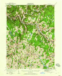
1921 Map of Livingston Manor
USGS Topo · Published 1952About this map
The Beaver Kill and Willowemoc Creek define the rugged character of this Sullivan County landscape, serving as the focal points for early 20th-century industry and transport. The New York Ontario and Western RR winds through these valleys, connecting established mountain communities like Livingston Manor and Roscoe. The map reveals a specialized local economy through industrial markers such as an Acid Plant, Dye Works, and a Creosote Plant, which processed the region's timber resources.
Find a feature on this map
96 named features on this map. Tap any name to fly to it.
Don’t see what you’re looking for? This feature index may not catch every label — zoom into the map to look around manually.
Map Details
Editions of this 1921 Livingston Manor Map
2 editions found
Other maps of this area

1901 · Margaretville
USGS Topo · 1:62,500

1904 · Margaretville
USGS Topo · 1:62,500

1909 · Monticello
USGS Topo · 1:62,500

1910 · Neversink
USGS Topo · 1:62,500

1911 · Monticello
USGS Topo · 1:62,500

1920 · Long Eddy
USGS Topo · 1:62,500

1920 · Damascus
USGS Topo · 1:62,500

1921 · Long Eddy
USGS Topo · 1:48,000

1922 · White Lake
USGS Topo · 1:62,500

1922 · Andes
USGS Topo · 1:62,500