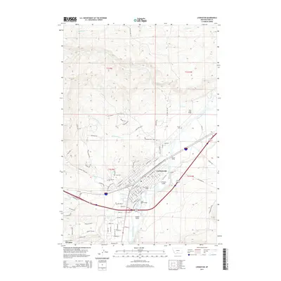
2014 Map of Livingston
USGS Topo · Published 2014About this map
The Yellowstone River anchors the geography of Livingston, carving through the valley floor and creating significant landforms like Livingston Island and Siebeck Island. During this period, the urban center is well-defined by a dense grid of streets, including E Callender St and N 5th St, while several crossings like the Main Street Bridge and Ninth Street Bridge link the river's banks. To the south, the settlement of Wineglass sits near the base of the rising terrain. The map records several notable local landmarks such as Mountainview Cem and Calvary Cem, providing valuable location data for genealogists. The surrounding landscape is marked by numerous drainages, including Fleshman Cr and Slaughterhouse Cr, which cut through the foothills below Stallion Rdg.
Find a feature on this map
89 named features on this map. Tap any name to fly to it.
Don’t see what you’re looking for? This feature index may not catch every label — zoom into the map to look around manually.
Map Details
Editions of this 2014 Livingston Map
This is the sole edition of this map. No revisions or reprints were ever made.
Other maps of this area

1891 · Livingston
USGS Topo · 1:250,000

1893 · Livingston
USGS Topo · 1:250,000

1947 · Bozeman
USGS Topo · 1:250,000

1948 · Bozeman
USGS Topo · 1:250,000

1951 · Gobblers Knob
USGS Topo · 1:24,000

1951 · Chadborn
USGS Topo · 1:24,000

1951 · Grannis
USGS Topo · 1:24,000

1951 · Brisbin
USGS Topo · 1:24,000

1951 · Hoppers
USGS Topo · 1:24,000

1951 · Livingston Peak
USGS Topo · 1:24,000