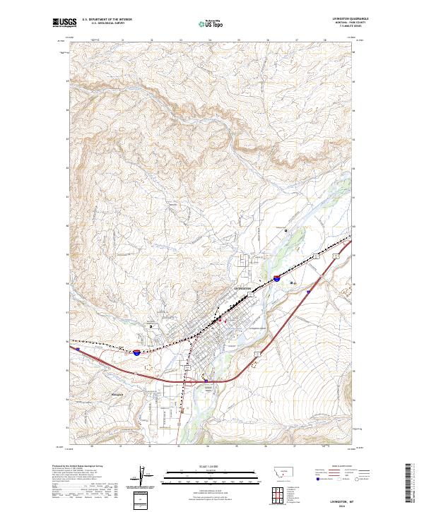
2024 Map of Livingston
USGS Topo · Published 2024About this map
Livingston serves as a major hub where the Yellowstone River meets a network of vital irrigation and drainage channels like the Livingston Ditch. The town's layout is defined by the river's path, featuring Livingston Island and Siebeck Island as prominent mid-stream landforms. The urban core is anchored by the City - County Complex, while residential expansion reaches toward the settlement of Wineglass to the southwest. Local history is preserved at Mountain View Cem and Calvary Cem, which overlook the valley floor.
Find a feature on this map
104 named features on this map. Tap any name to fly to it.
Don’t see what you’re looking for? This feature index may not catch every label — zoom into the map to look around manually.
Map Details
Editions of this 2024 Livingston Map
This is the sole edition of this map. No revisions or reprints were ever made.
Other maps of this area

1891 · Livingston
USGS Topo · 1:250,000

1893 · Livingston
USGS Topo · 1:250,000

1947 · Bozeman
USGS Topo · 1:250,000

1948 · Bozeman
USGS Topo · 1:250,000

1951 · Gobblers Knob
USGS Topo · 1:24,000

1951 · Chadborn
USGS Topo · 1:24,000

1951 · Grannis
USGS Topo · 1:24,000

1951 · Brisbin
USGS Topo · 1:24,000

1951 · Hoppers
USGS Topo · 1:24,000

1951 · Livingston Peak
USGS Topo · 1:24,000