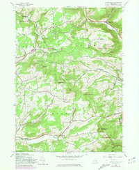
1945 Map of Livingstonville
USGS Topo · Published 1981About this map
Livingstonville and the winding course of Catskill Creek anchor this mid-century portrait of Schoharie County’s uplands. The map reveals a landscape defined by small crossroads settlements and high-elevation terrain, where agricultural life was increasingly giving way to state-managed forests. Extensive tracts labeled Reforestation Area sprawl across the hillsides, signifying the shift toward conservation that reshaped New York's rural geography during this era.
Find a feature on this map
34 named features on this map. Tap any name to fly to it.
Don’t see what you’re looking for? This feature index may not catch every label — zoom into the map to look around manually.
Map Details
Editions of this 1945 Livingstonville Map
2 editions found
Other maps of this area

1893 · Durham
USGS Topo · 1:62,500

1894 · Durham
USGS Topo · 1:62,500

1898 · Schoharie
USGS Topo · 1:62,500

1900 · Schoharie
USGS Topo · 1:62,500

1900 · Berne
USGS Topo · 1:62,500

1901 · Gilboa
USGS Topo · 1:62,500

1903 · Gilboa
USGS Topo · 1:62,500

1903 · Berne
USGS Topo · 1:62,500

1943 · Breakabeen
USGS Topo · 1:24,000
1944 · Middleburgh
USGS Topo · 1:24,000